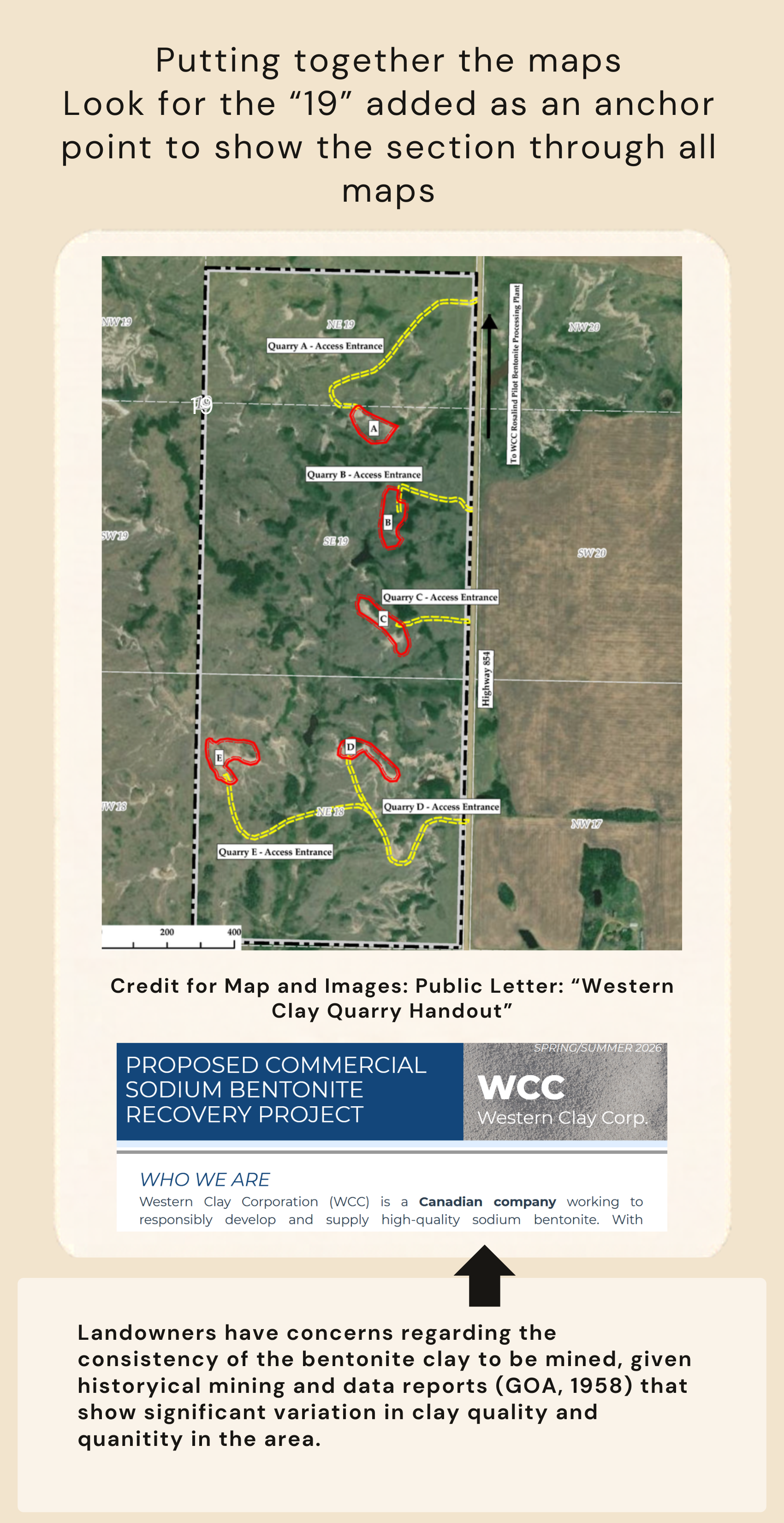
Putting the Maps Together
The potential visual impacts of the project on adjacent landowners are deeply concerning.
All of these hills could be gone, replaced with a barren erosion scar.
Then add the roads…
Neighbouring landowners are concerned about the likely negative impact of the project on existing agricultural operations and the environment. These concerns are informed by research, first-hand experiences, and local knowledge, which includes the well-document and long history of erosion and slope instability at the adjacent Battle River Bridge site.
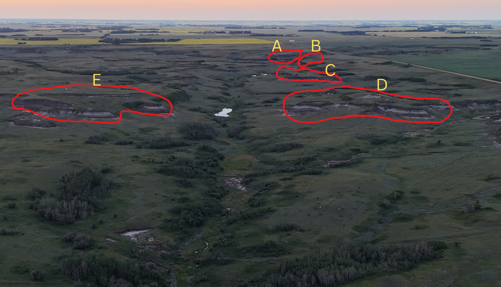
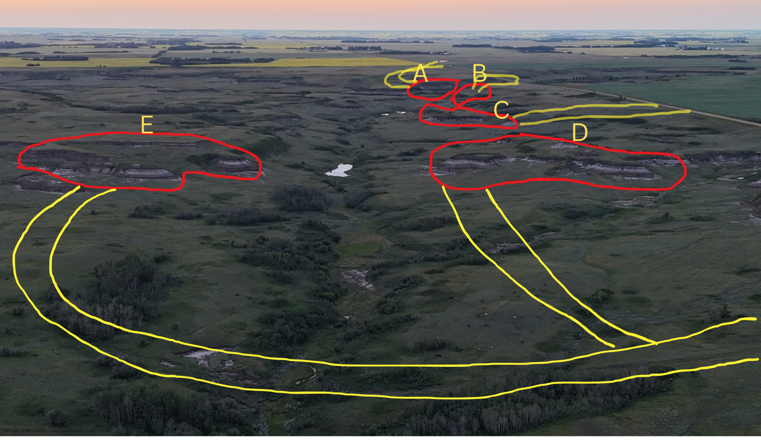
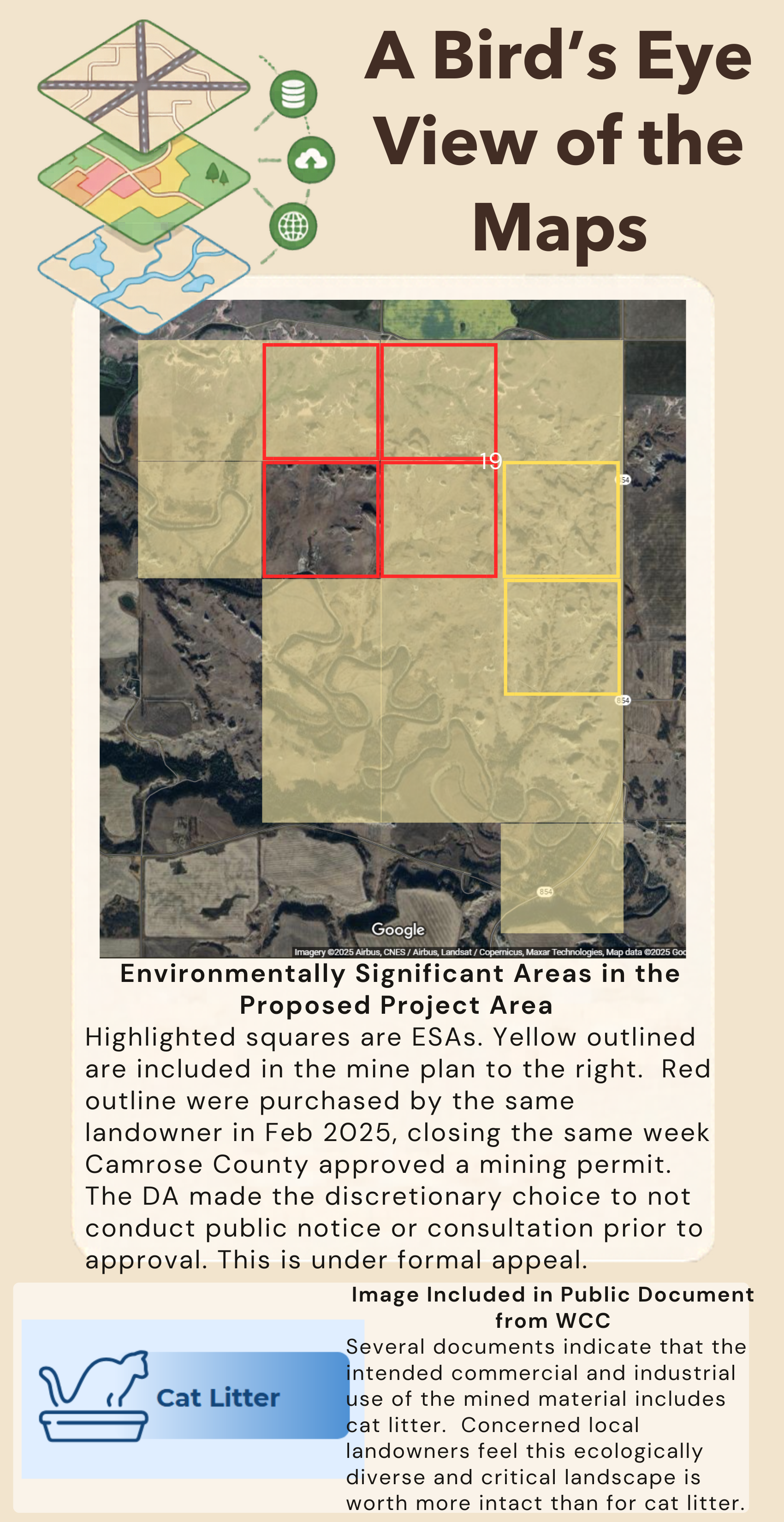
This project could impact at least 8 environmentally significant and agriculturally productive quarter sections of land:
3 with the proposed mine plan and access roads
3 to the west via erosion
2 to the south and southwest with downstream drainage, impacting erosion and water quality where a creek runs into the Battle River
Drainage changes and water quality impacts would be even farther reaching.
This does not even consider that the open topography of the valley means there could be a line of site on mining sites and scars for miles, dragging down property value for many local landowners.
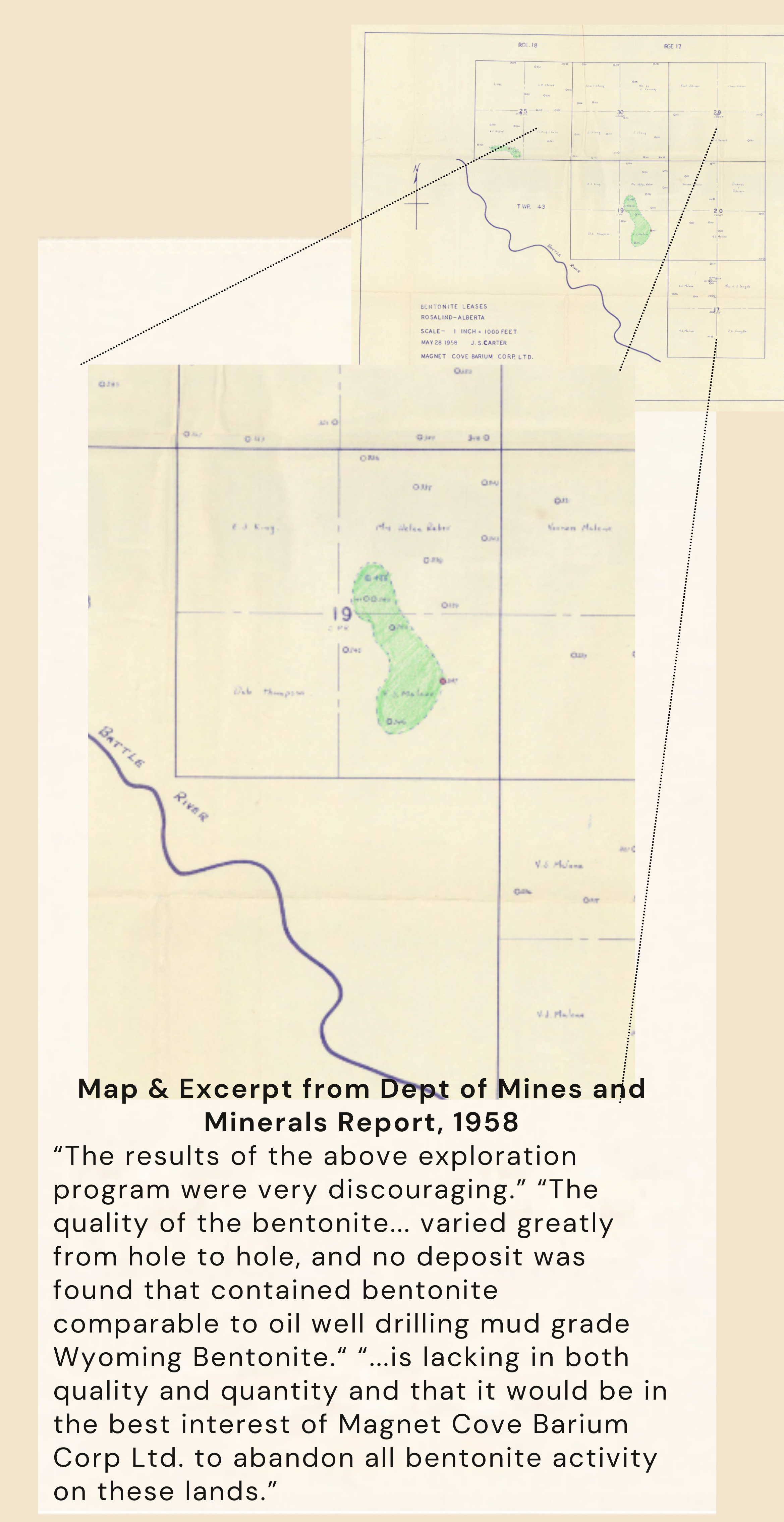
Reports from the area specifically named 31-42-17-W4M, rather than the sections 19-43-17-W4 or NW-18-43-17-W4 covered under the application, as having high quality bentonite comparable to product imported from the United States (GOA, 1958). This area, which was indicated to have 500,000 tonnes of bentonite was mined by MacoBar/Dresser from the 1950’s-70’s and can be seen in the mining scar imagery on this website. Mapping shows only 4 areas deemed potentially suitable for mining purposes due to size and quality and included the Dresser/MacoBar mine site and can be see indicated in green.
Various public documents discuss the end use as being for consumer and industrial uses, including for cat litter.
“Land is a limited, non-renewable resource and so should not be wasted. Land-use decisions should strive to reduce the human footprint on Alberta’s landscape. When it comes to land use, other things being equal, less is more - more choices for future generations.” Land Use Framework (Government of AB, 2008)
“Clean air and water, healthy habitat and riparian areas, abundant wildlife species and fisheries are all ‘public goods’ Albertans enjoy and value.
The amount of environmentally significant area potentially impacted is extensive. This landscape would likely not be recoverable after intensive disturbance from strip mining. This landscape is a working landscape, providing grazing and agricultural benefits, while also providing ecosystem services. With the end use being commercial and industrial uses, which include cat litter, and the clear language in the Land Use Framework, it must be considered that this project is not in the public interest.
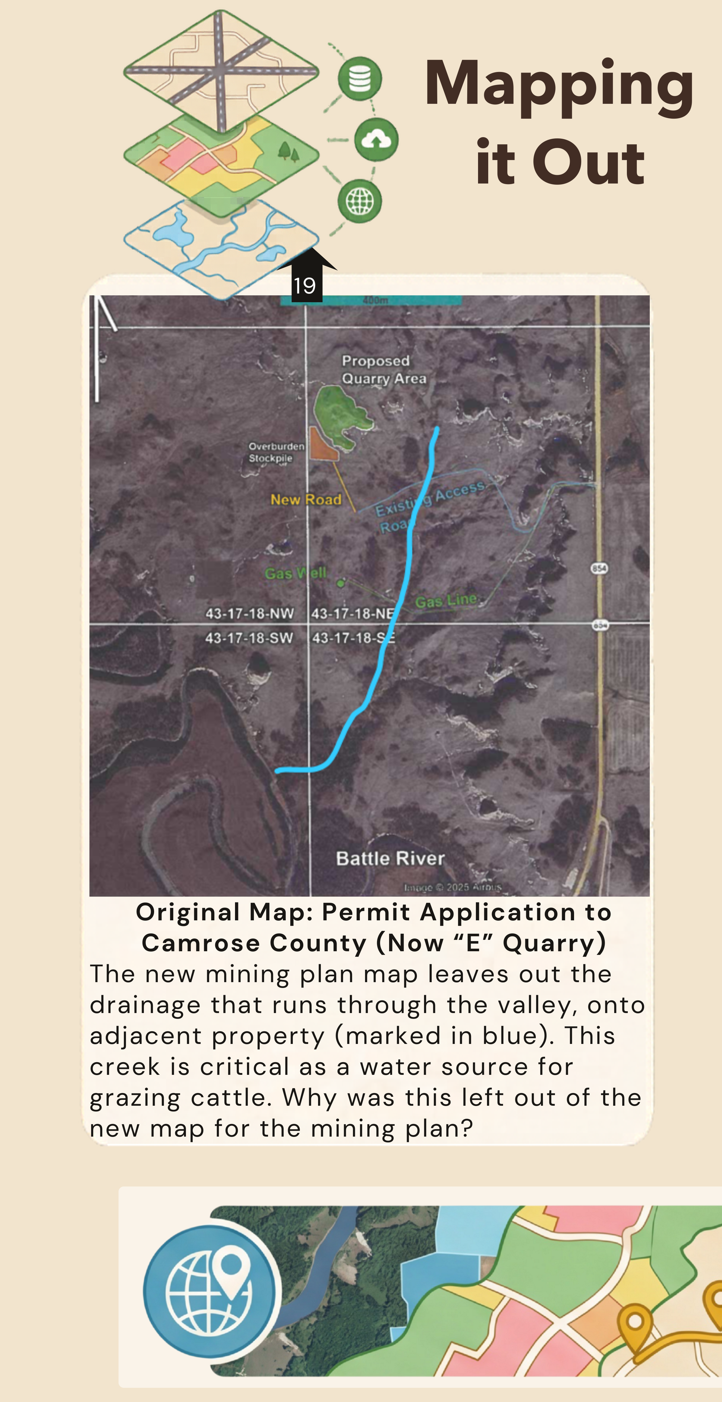
Mapping the Impact