The Most Endangered Ecosystem
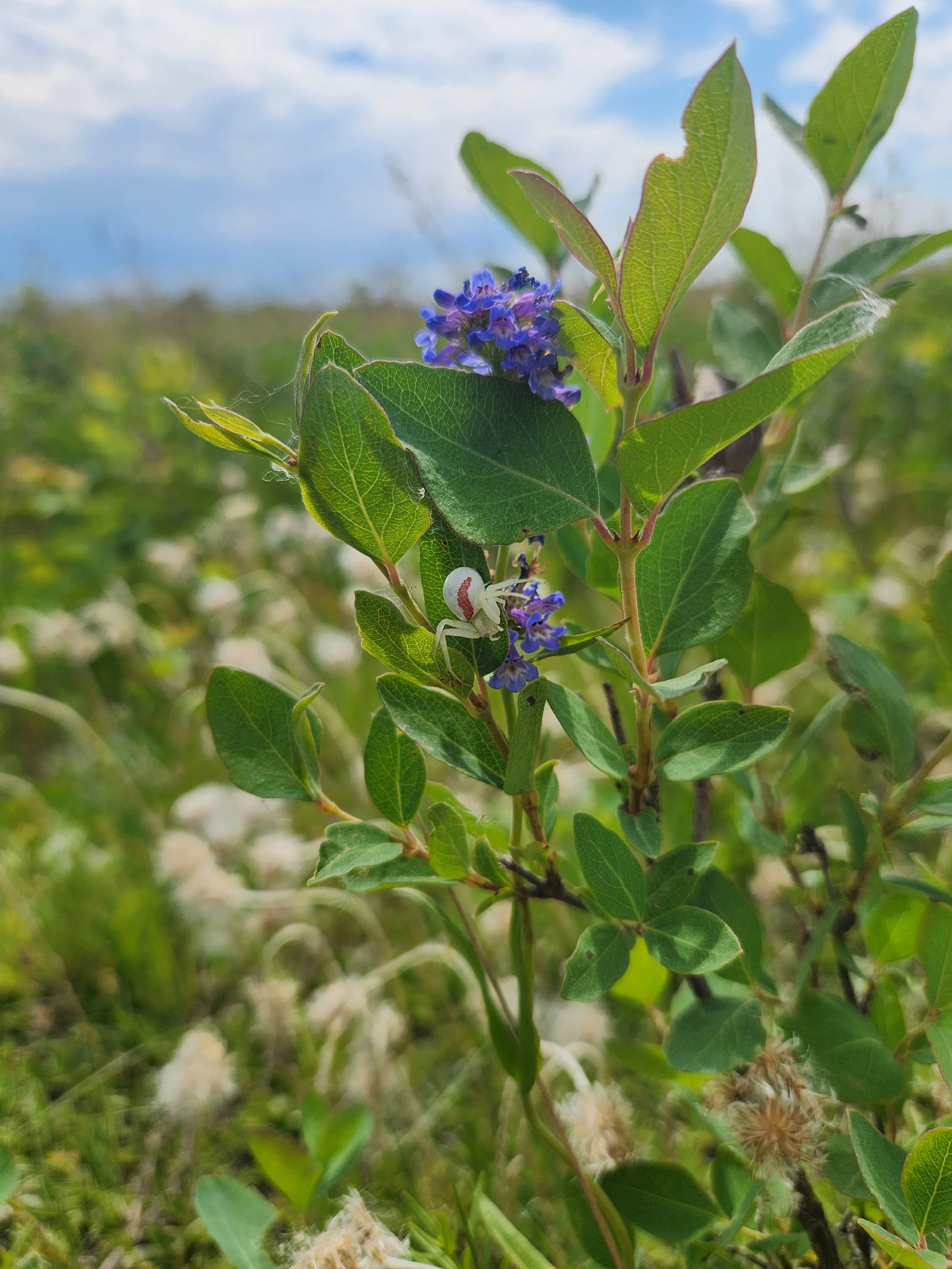
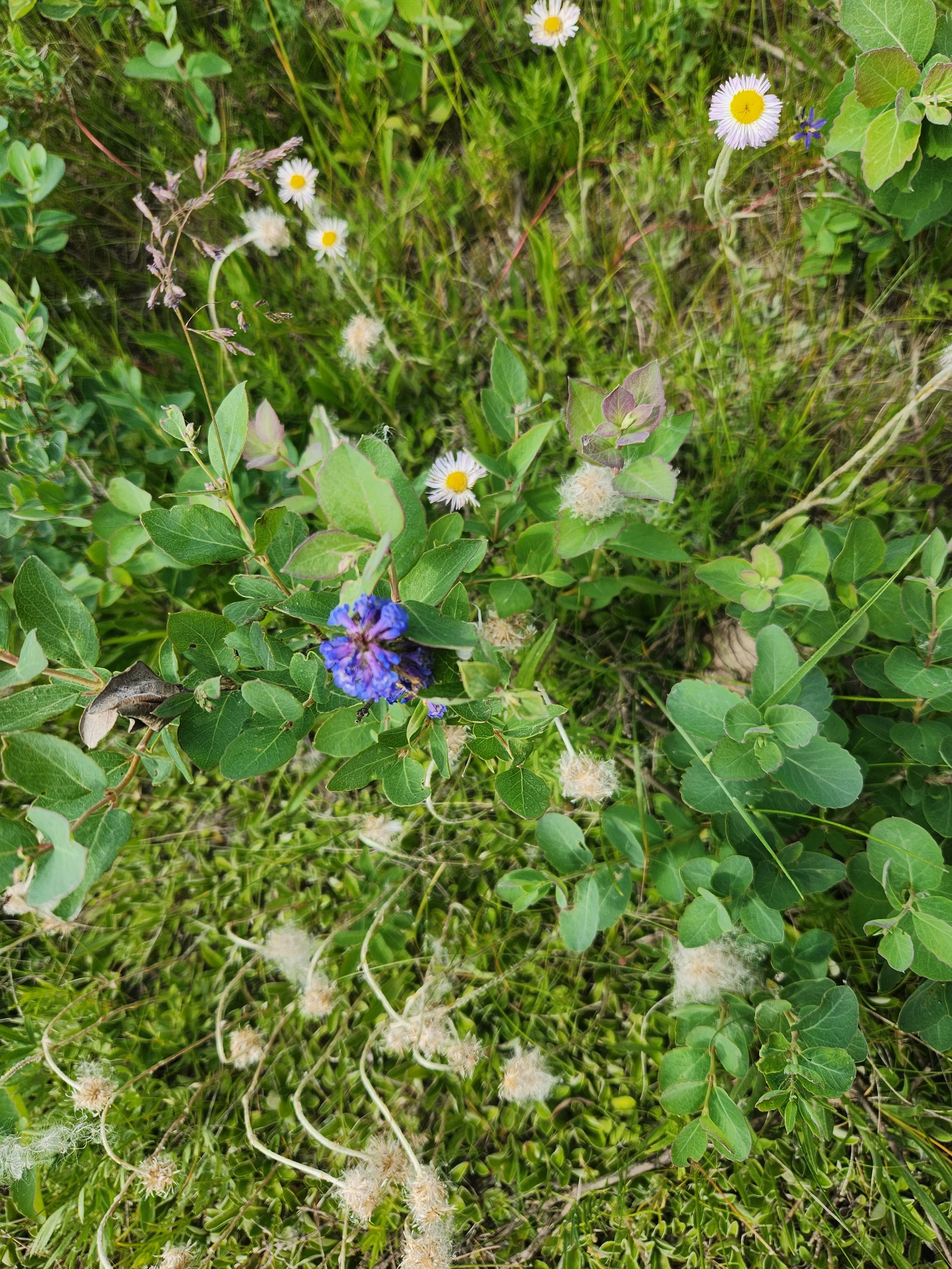
Native Grasslands are recognized as the single most endangered ecosystem in Canada and internationally recognized as one of the world’s most endangered ecosystems
Only 5% of Aspen Parkland remains in Alberta
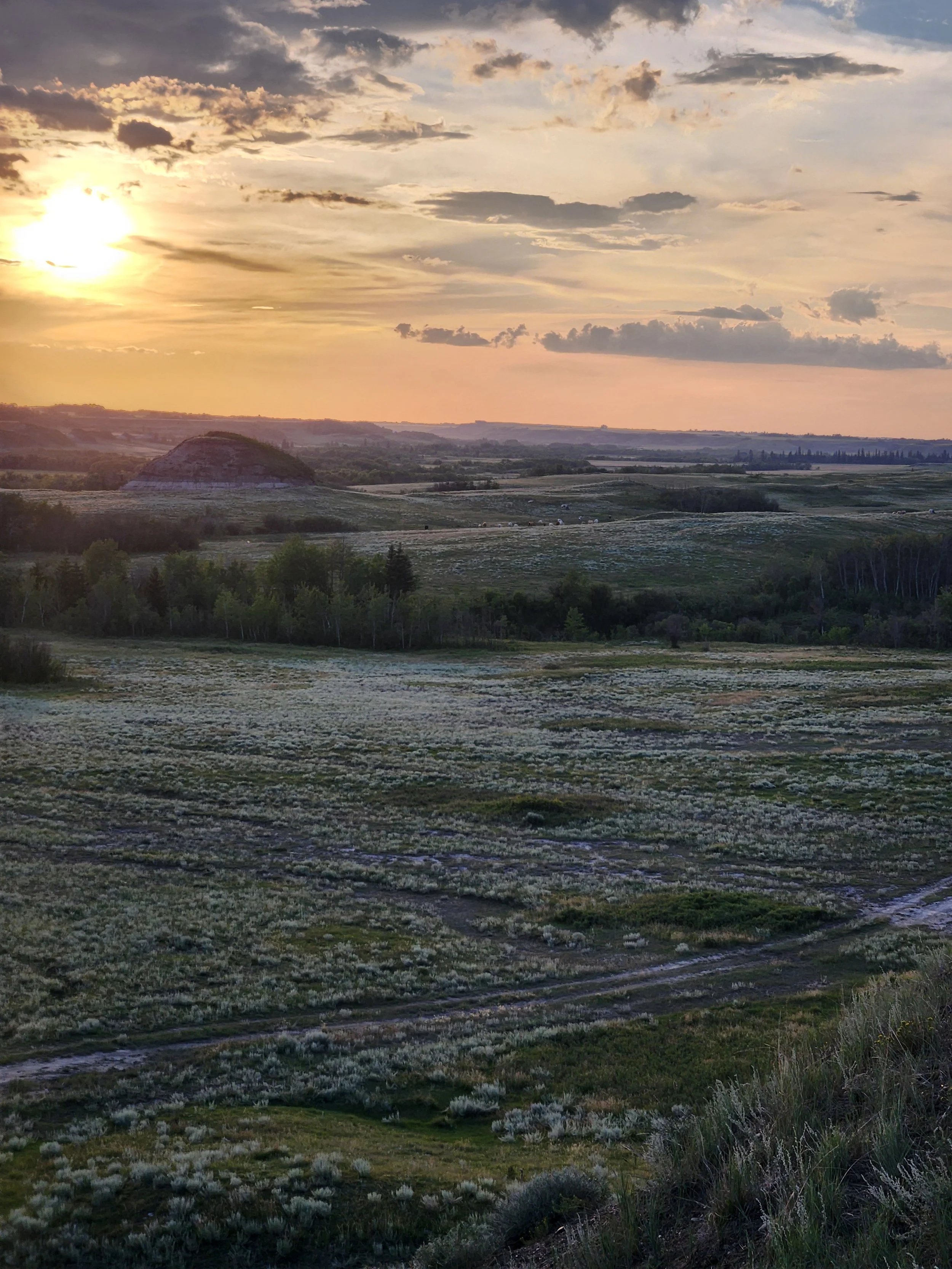
A sodium bentonite clay strip mine is proposed in the most endangered ecosystem in Canada. Rough fescue habitat is disappearing, with no seed source to replace it. Native grasslands are increasingly rare (GOA, 2006). “The proposed strip mine site is in one of the few remaining places where biodiversity is high, ecosystems are intact, and suitable habitat for native species still exist” in the aspen parkland (AWA, 2025; AWA. 2026; ABMI, 2025; APCF, 2026).
Links:
Land-Use Framework Final Report (Government of Alberta (GOA), 2008)
Natural Regions & Subregions of Alberta: A Framework for Alberta Parks (GOA (Government of Alberta), 2006)
APCF Alberta Prairie Conservation Forum - Central Parkland Tab
AWA - Alberta Wilderness Association 2026
AWA - Desktop Review of Env Data & Biodiversity Indicators in Camrose County 2025
In 2011, the Paintearth Sub-basin of the Battle River, where this strip mine is proposed, was estimated to provide $696 million in societal benefits by natural ecosystems.
Adjusted for inflation, this means ecological goods & services would be valued at over $972 million in 2026. This is likely a low estimate, considering more recent valuation metrics below.
Landscape connectivity is essential to maintaining ecosystem function and biodiversity. (Liu et al., 2018)
Links:
Taking Notice to Taking Action: A Health in the Watershed Atlas of the Battle River and Sounding Creek Watersheds (Hallstom et al, 2022)
Deep Roots: A Carbon Sink - Erosion, Drought and Flood Mitigation
Prairie grasslands sequester carbon below the ground, making it a stable carbon sink. An estimated 200 tonnes of carbon per hectare is stored in the first metre (APCF). Market value of stored carbon in Alberta exceeds $9 billion (Bork, 2016). Natural grasslands are far more effective at sequestering carbon than even restored grasslands and degrading grasslands releases carbon, while restoring natural grasslands and their ecosystem function is incredibly difficult (Buisson et al., 2023; Plantlife, 2023, Liu, L. et al., 2022; Yang, Y. et al., 2019),
Native grassland species have deep roots that help to prevent erosion. They also increase infiltration of water, keeping water in the landscape longer. This means reduced runoff, preventing flooding and increased infiltration and water storage, which helps to prevent drought. (ELC, 2026)
Links:
Links Between Grassland and Carbon Storage (Alberta Prairie Conservation Forum)
Prairie Conservation Action Plan
Carbon Benchmarking in Alberta Grasslands (Bork, 2016)
Ancient Grasslands Guide Ambitious Goals in Grassland Restoration (Buisson et al., 2022)
Grasslands as a Carbon Store (Plantlife, 2023)
The Grassland Carbon Cycle (Liu, L.et al., 2022)
Soil Carbon Sequestration… (Yang, Y., 2019)
Grasslands and Drought Management in Alberta (ELC, 2026)
The Battle River - An Interprovincial River; An Area of National Concern
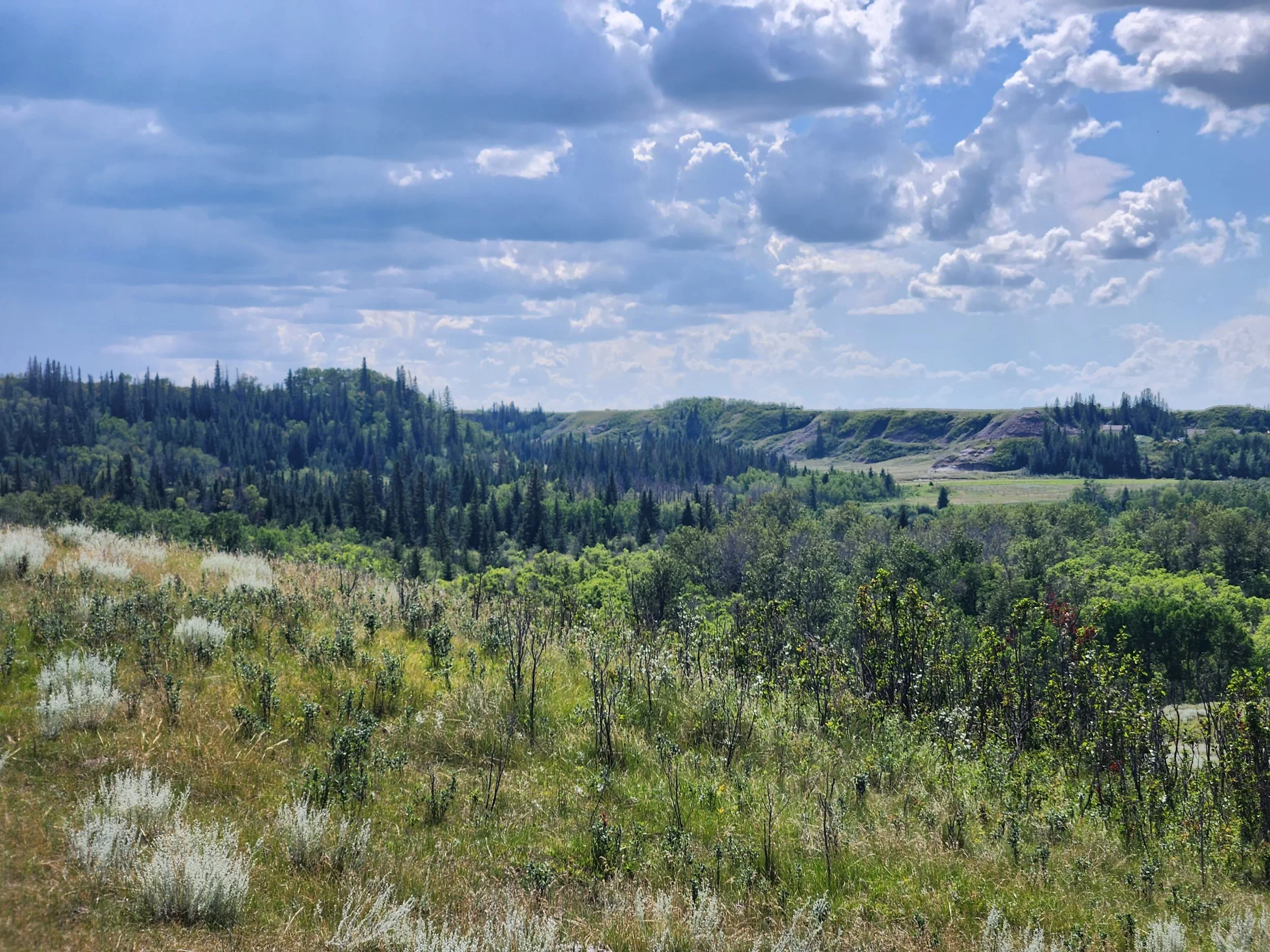
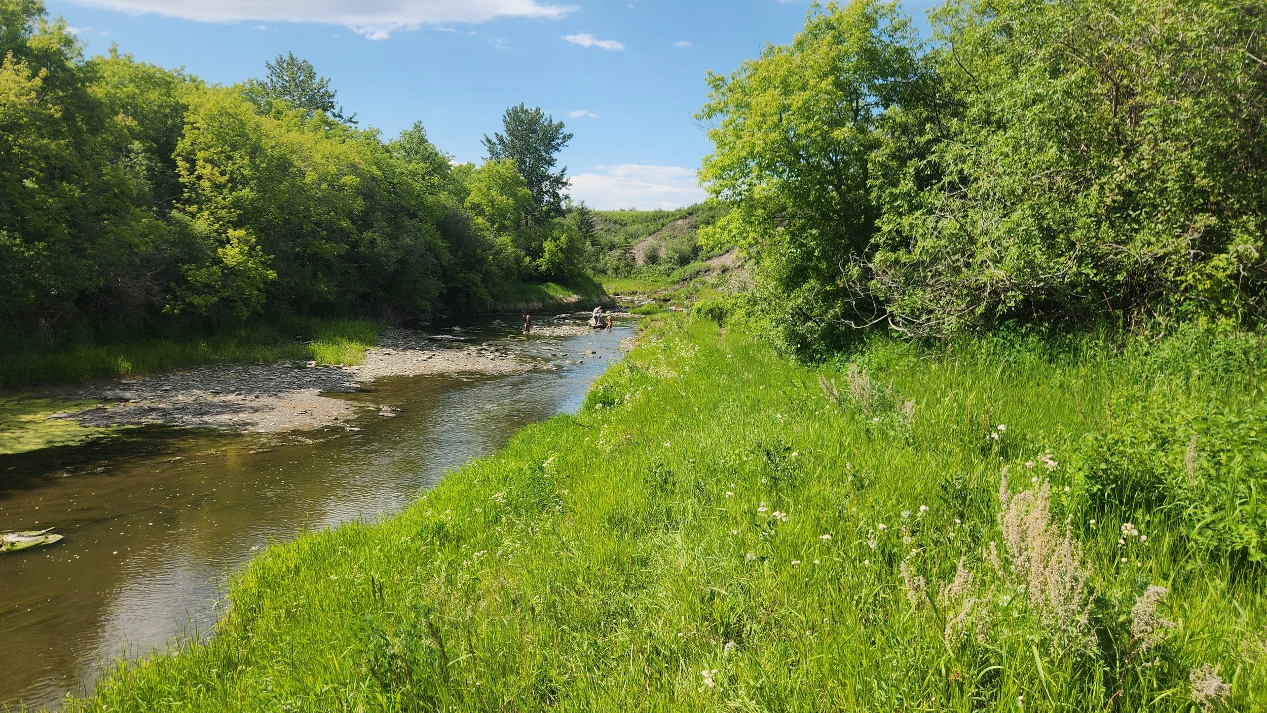
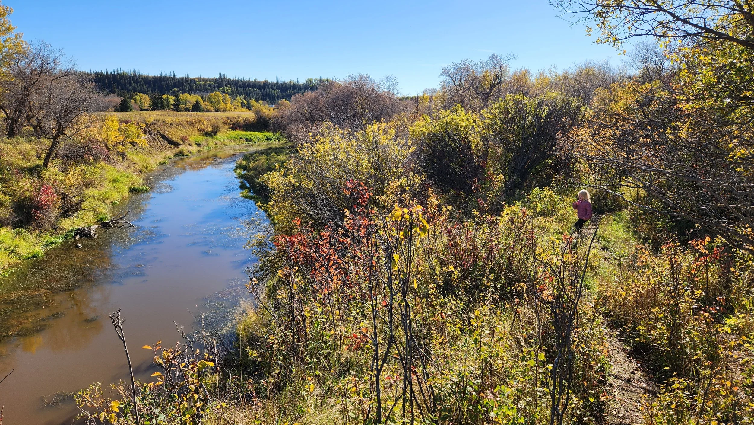
The proposed strip mine is the in drainage basin for the Battle River Watershed. Valley topography clearly shows natural drainage in a creek that runs through adjacent property. This creek and surrounding area is identified by the Riparian Web Portal as a conservation priority. This is directly downstream of the proposed mine site.
This particular area is identified as an Environmentally Significant Area of “at least” National Significance.
Links:
Riparian Web Portal - Report to Camrose County
Environmentally Significant Areas in Alberta (Fiera, 2014)
Environmentally Significant Areas Report - Vol 2. Pg. 19: Battle River - Bignknife (Sweetgrass, 1997)
Environmentally Significant Areas (ESA’s) in Alberta - Map (Alberta Tourism, Parks and Recreation, 2014)
Ecological Goods and Services Calculator
It is widely accepted that natural landscapes provide ecosystem services that must be considered in land use decision-making. Loss of ecosystem function through disturbance and habitat fragmentation must be weighed against any projected profit, particularly on a one-time use of a the landscape vs. the yearly contribution of natural ecosystems to the societal good.
The Ecosystem Services Value Calculator (Oldman Watershed Council), developed with the support of the Government of Alberta, estimates 160 acres of strictly grassland provides $251,294 of ecosystem services per year. If 8 quarters are impacted, over $2 million PER YEAR would be lost in ecosystem services.
This is a very conservative estimate. The downstream areas impacted, as well as the project area itself, include riparian areas, which greatly increase ecosystem services they account for. Even the riparian 80m wide and 1km long, a conservative 2 acres of riparian area boosts ecosystem services by $98,421 per year. The 220 acres directly downstream of the project area produce an estimated $1,377,884 in ecosystem value per year.
Upstream disturbance will have a negative impact on water quality, quantity and riparian health through the entire creek, a direct tributary of the Battle River (Marshall, H., 2017)
What is an ESA?
An Environmentally Significant Area is
Important to the long-term maintenance of biological diversity, soil, water, or other natural processes
Areas that contain rare or unique elements that may require special management consideration due to their conservation needs
This area is designated as an ESA because it is “one of the most intact valley complexes in the Parkland Region of Canada” and “diverse valleys with uncultivated bottomlands are rare in the Aspen Parkland.” (Sweetgrass, 1997). This report declared the area “of national significance.”
This area should be a concern for public interest by Camrose County, residents of Alberta, and Canada.
Links:
Environmentally Significant Areas in Alberta (Fiera, 2014)
Environmentally Significant Areas Report - Vol 2. Pg. 19: Battle River - Bigknife (Sweetgrass, 1997)
Unique Topography - Unique Concern
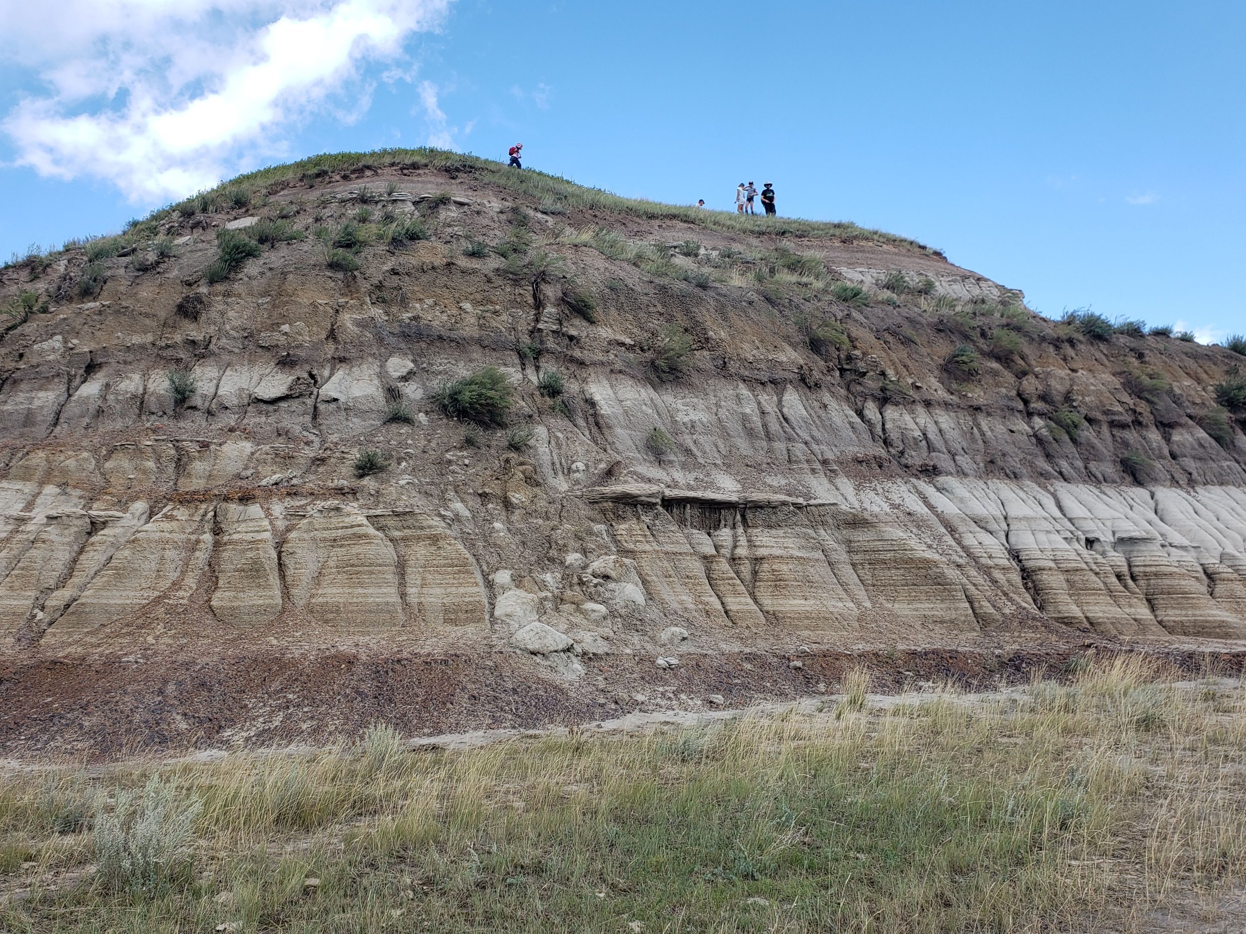
The formation of the Battle River valley by glacial floodwaters scoured away topsoil, leaving the Horseshoe Canyon formation exposed. this is the same formation exposed at Dinosaur Provincial Park. This unique topography has led to the unique landforms of the valley, including hoodoos and the steep, popcorn-texture sodium bentonite clay hills that erupt from the valley floor. Fossils have also been found in this formation.
Highly erodible bedrock is exposed in this area, this, with extreme slopes . Any slope greatly increases erosion rates in this area. Mechanical changes that remove vegetation and harder layers like ironstone will elevate the risk of erosion further. Natural vegetation and minimizing disturbance is critical to maintaining this landscape.
(Alberta Transportation, 2003-2013; Bryan et al., 1986, Campbell, 1987, Campbell, 1970, Evans, 2000, Gravenor, 1956, Gravenor & Bayrock, 1956, Kerr & Cook, 2017, Parker, 1963, Scafe, 1975)
Links:
Alberta Transportation: Geohazard Assessments Site C23: H854:01 (Alberta Transportation, 2003-2013)
Postglacial Geomorphic development of Dinosaur PP (Bryan et al., 1986)
Erosion Rates in Steveville Badlands (Campbell, 1970)
Canadian Landforms Examples (Campbell, 1987)
Geology & Geomorphology of the Dinosaur PP (Evans, 2000)
Glacial Geology of the Castor District (Gravenor, 1956)
Stream-trench Systems in East-Central AB (Gravenor & Bayrock, 1956)
Erosion of the AB Badlands produces highly variable & elevated metal concentrations in the Red Deer River (Kerr & Cooke, 2017)
Alberta Bentonites (Scafe, 1975)