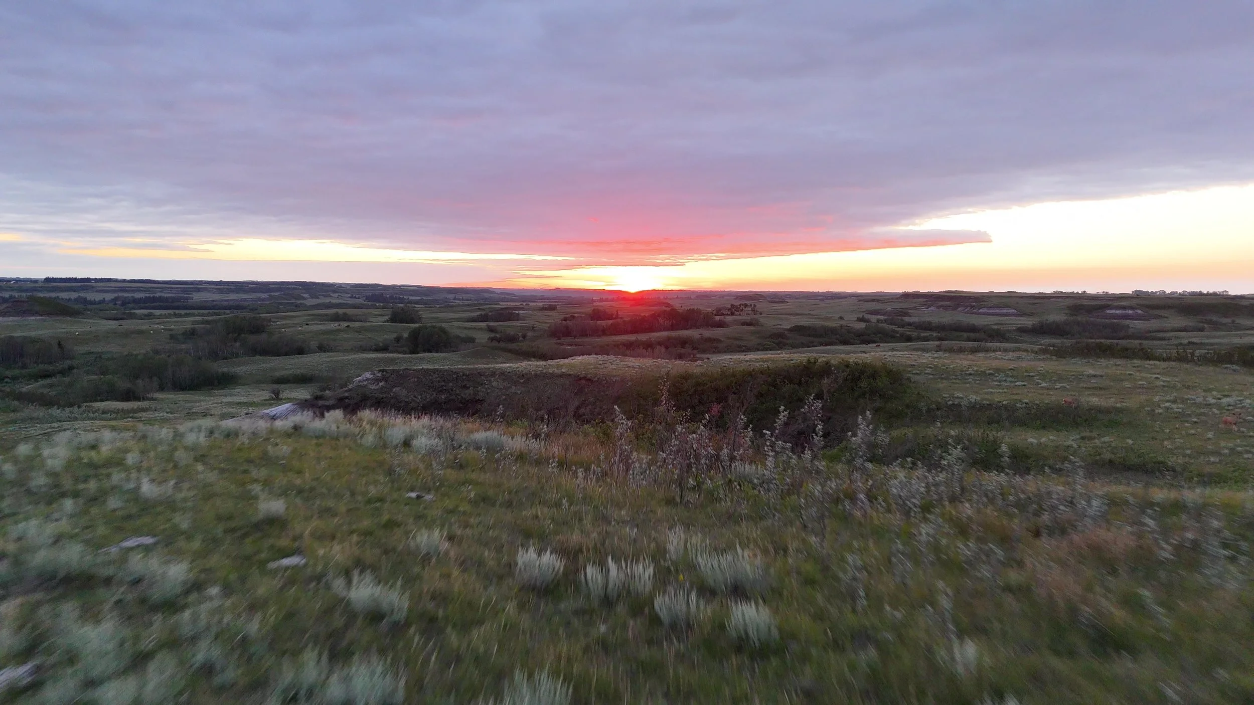
Protecting our Parkland
photos & videos of Battle River Valley - Rosalind Alberta
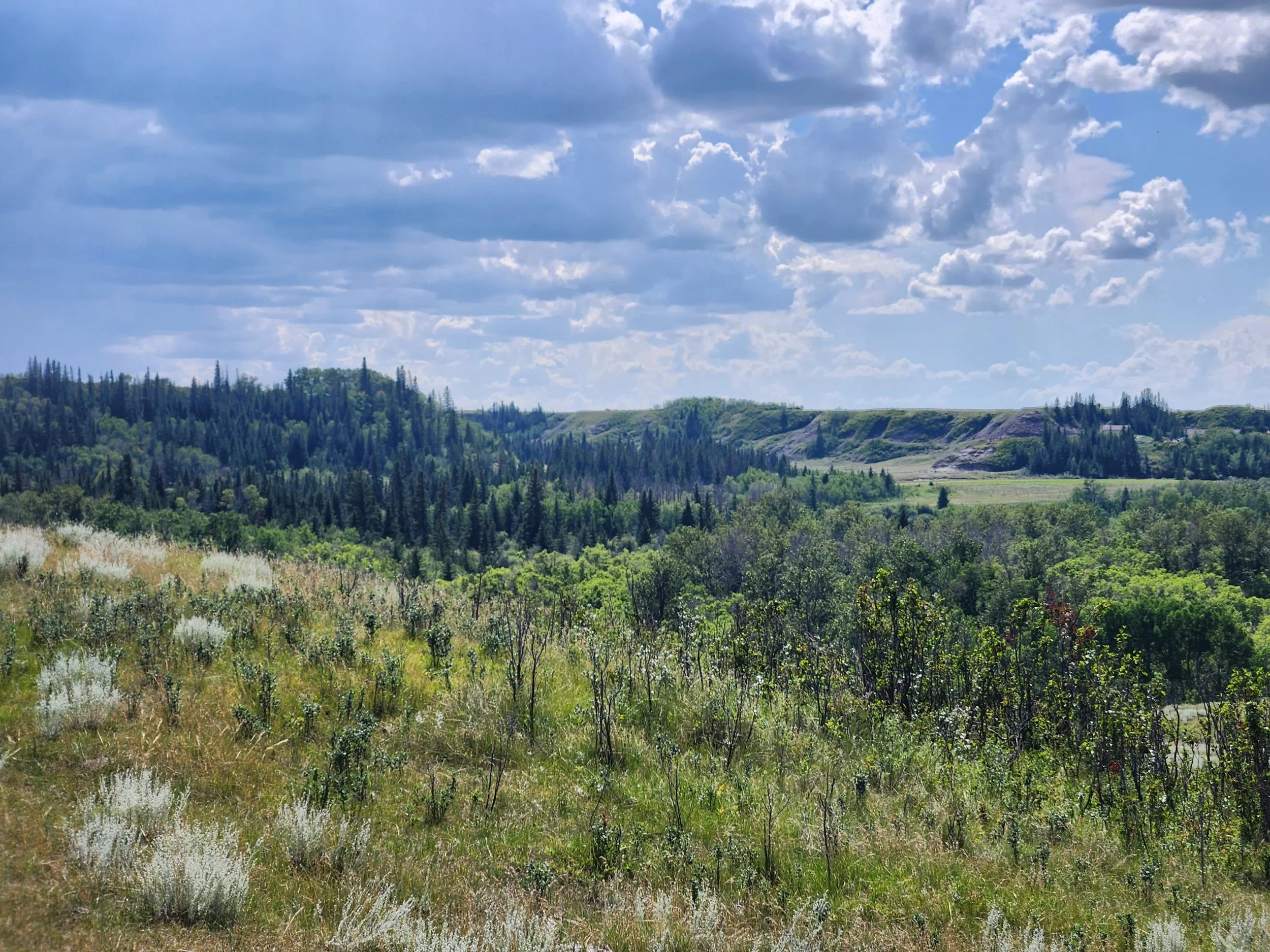
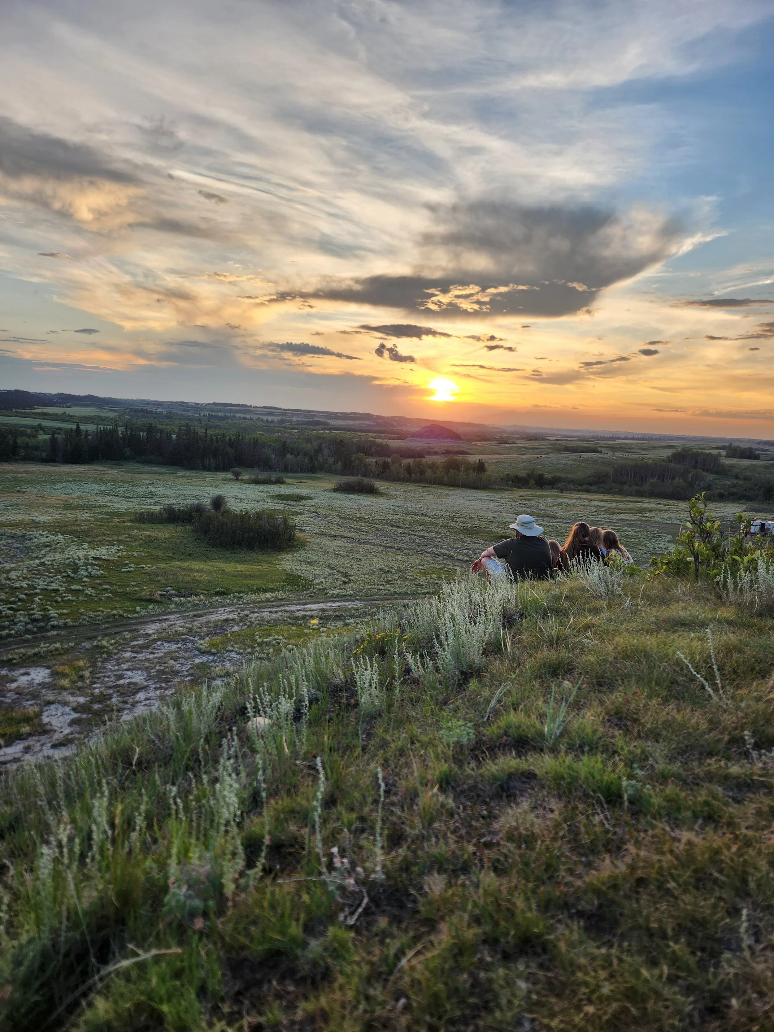
Prairie, and more specifically, Aspen Parkland, is the single most endangered ecosystem in Canada.
Only 5% of Aspen Parkland remains in Alberta
This is a working landscape, providing rangeland for grazing, economic and ecological benefits, and is a living museum for the landscape from before cultivation.
It is our gem.
It is ours to protect for future generations.
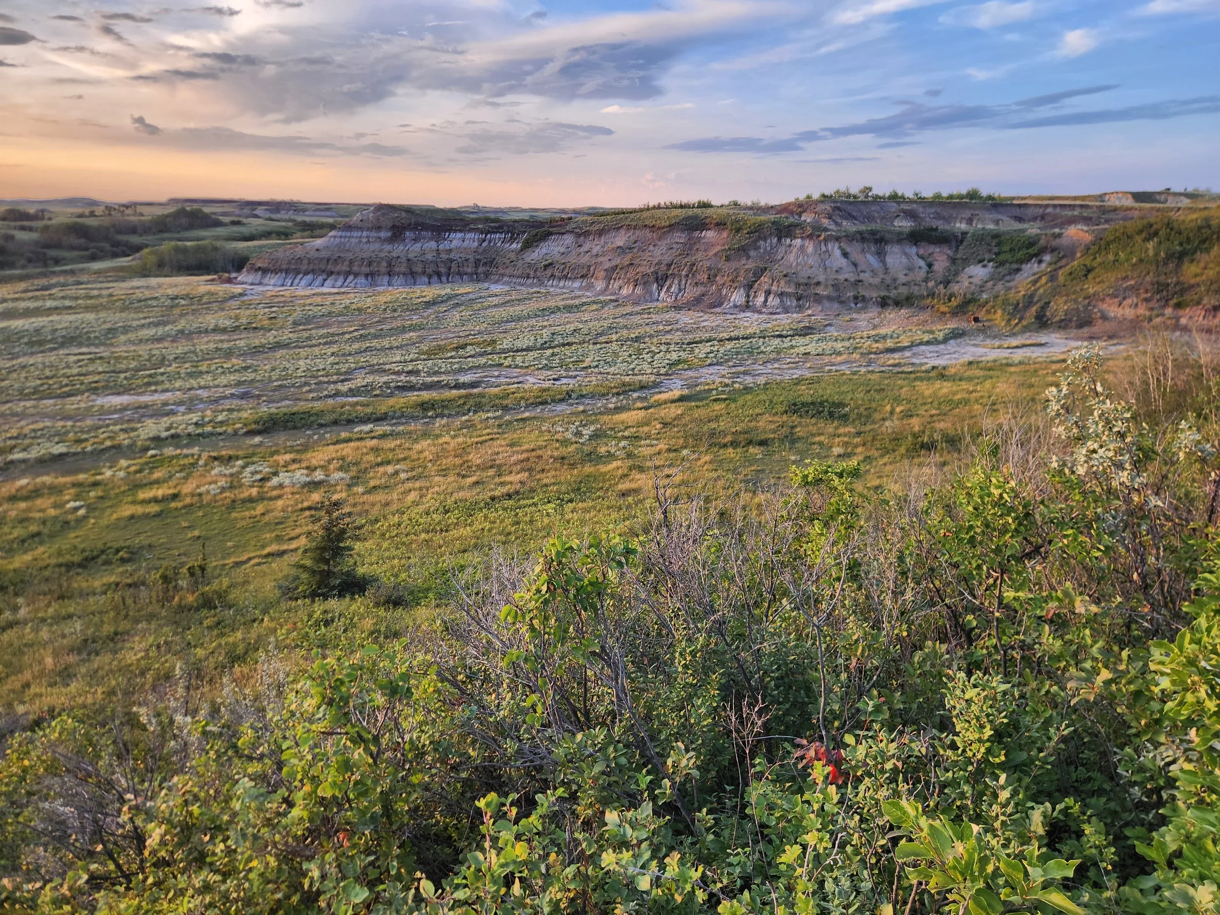
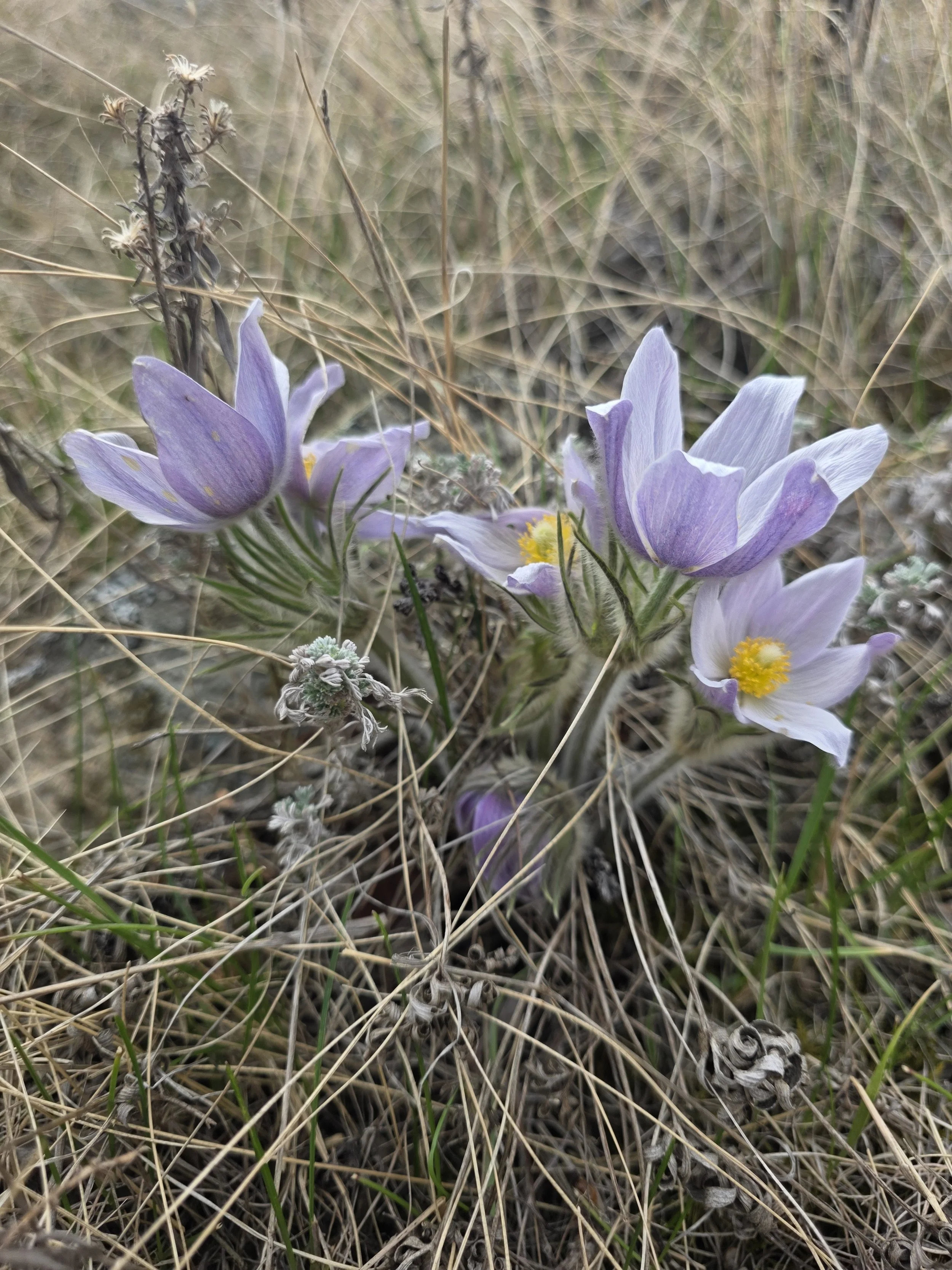
plans for sodium bentonite clay mining for consumer and industrial applications, including cat litter, could destroy this unique and valuable ecosystem
In 2025 a mining permit for a sodium bentonite strip mine was granted by Camrose County, which, while not obligated, had the discretionary option to conduct public notification and consultation prior to approval as part of their decision making process, but chose not to do so, for this development on environmentally significant, agricultural land in the Battle River valley near Rosalind. Adjacent landowners were notified after the permit was granted; many severely impacted people were not notified as only landowners within the minimum required distance were notified. Formal appeals were made to the Land and Property Rights Tribunal by impacted people and those who are concerned about the potential damage that could be caused by this type of strip mining, with supporting evidence. This led to a hearing, which is currently on hold while the company pursues approval from AER. However, in its previous communications to Camrose County during the development permit application, the Company had stated that the "AEP approval is not required" (Thibault, January 28, 2025). For Water Act Approvals, the Company also noted that “Water Act Approvals (not applicable): our operations does not impact water bodies, groundwater, or wetlands, nor does it in any way interact with the water table." The Battle River Badlands Society, along with local landowners, have great concerns about impacts to water quality, particularly with plans to cross existing riparian areas with roads and potential for increased erosion, which could have a negative impact on their agricultural operations, ecosystem services and habitat.
Many local landowners feel that permit should never have been granted: Camrose County bylaws and the Provincial Land Use Framework clearly states mining is a discretionary land use on agricultural land and “MUST NOT” be permitted if it has any negative impact on adjacent agricultural operations. Appellants have formally expressed their opinion on these negative impacts. Consideration of cumulative impacts of land uses is also accepted practice.
Several existing operations stated that they were not consulted, as they were not even aware of the application until after the permit was granted.
For mobile devices, turn your phone sideways for best viewing
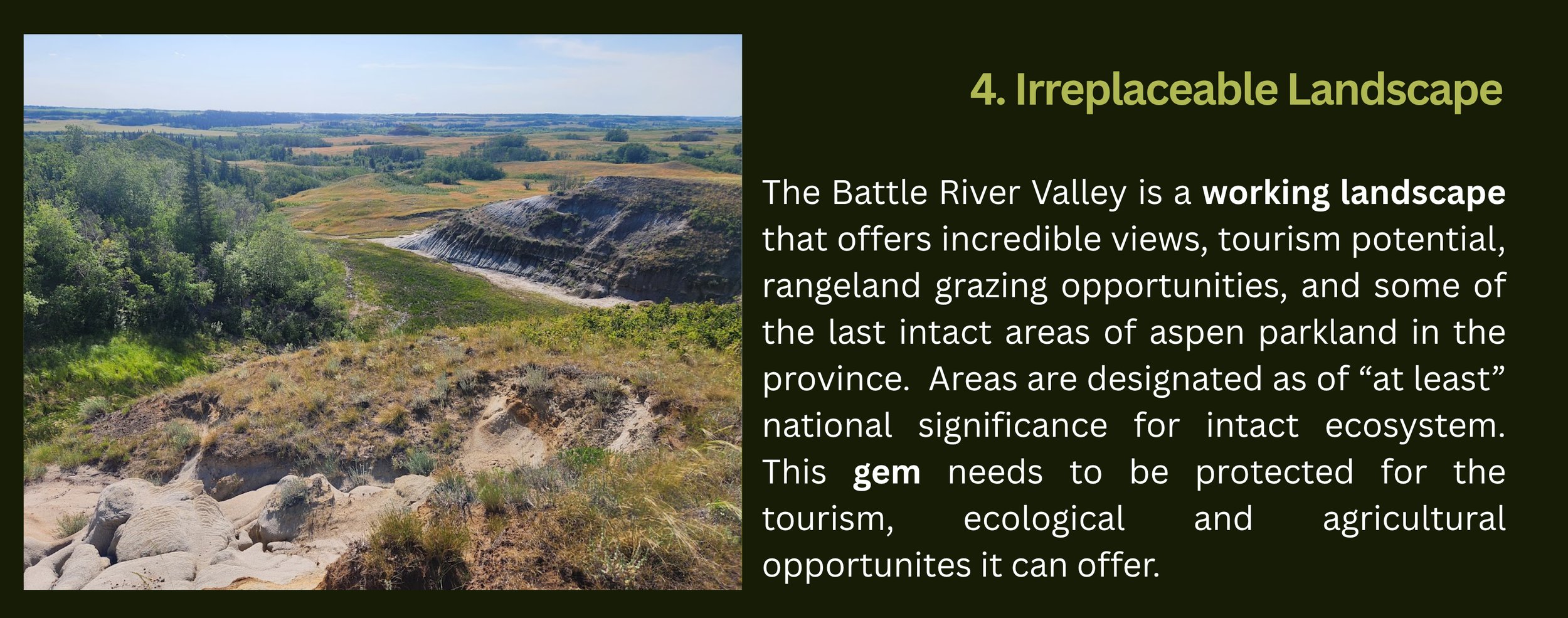
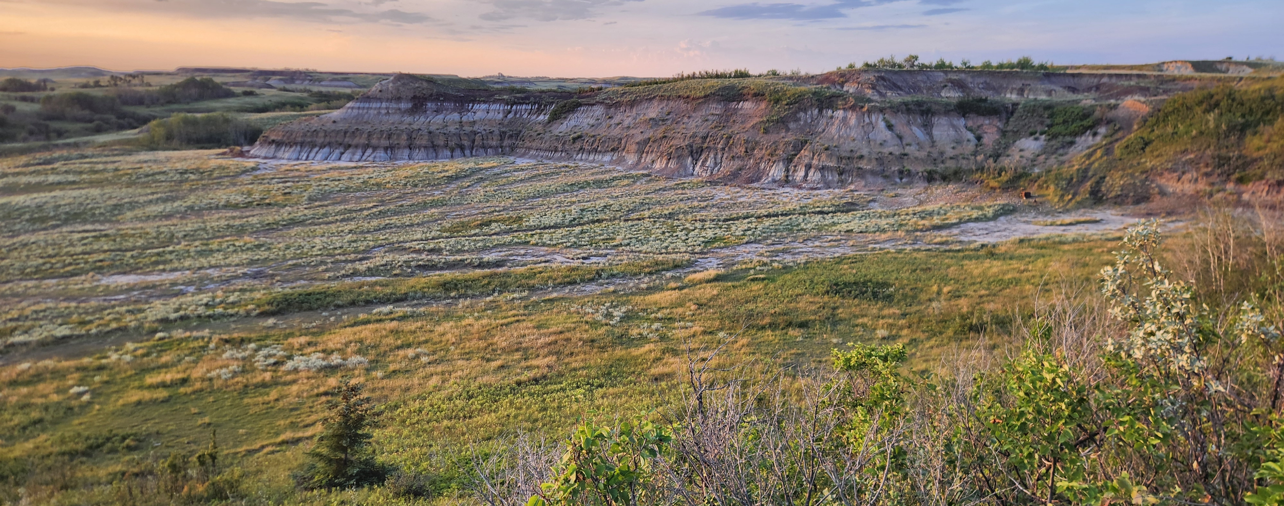
This land where mining is proposed is designated by the Province of Alberta as environmentally significant areas (ESA’s) in multiple reports, stating intactness of the ecosystem. Generations of people have kept this ecosystem intact.
These and the surrounding landscape are identified as of at least national significance and as a conservation priority.
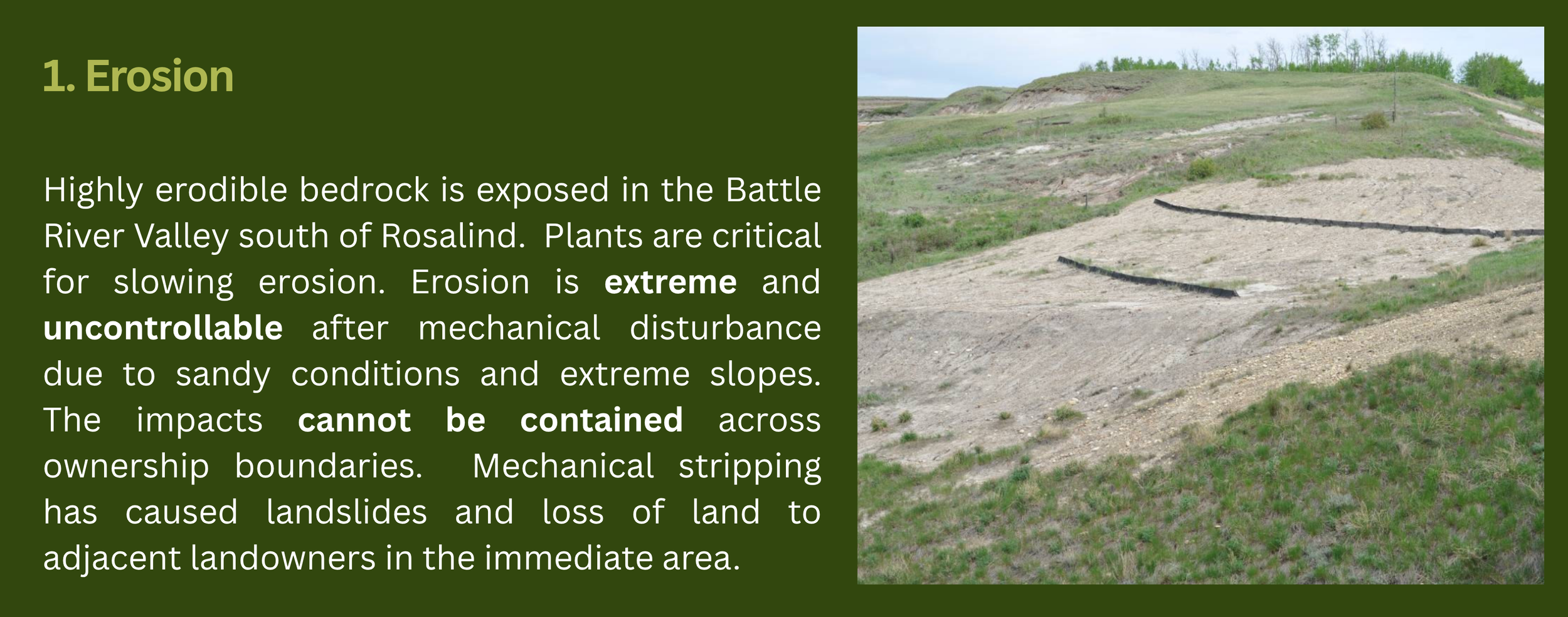
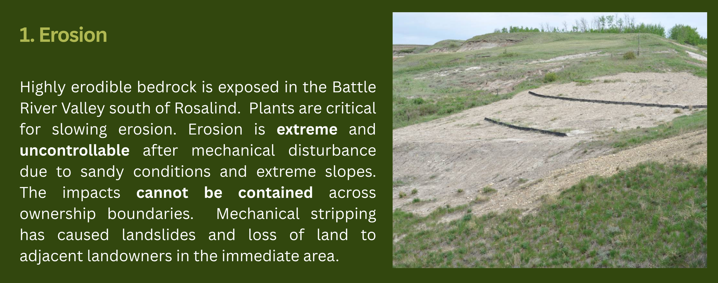
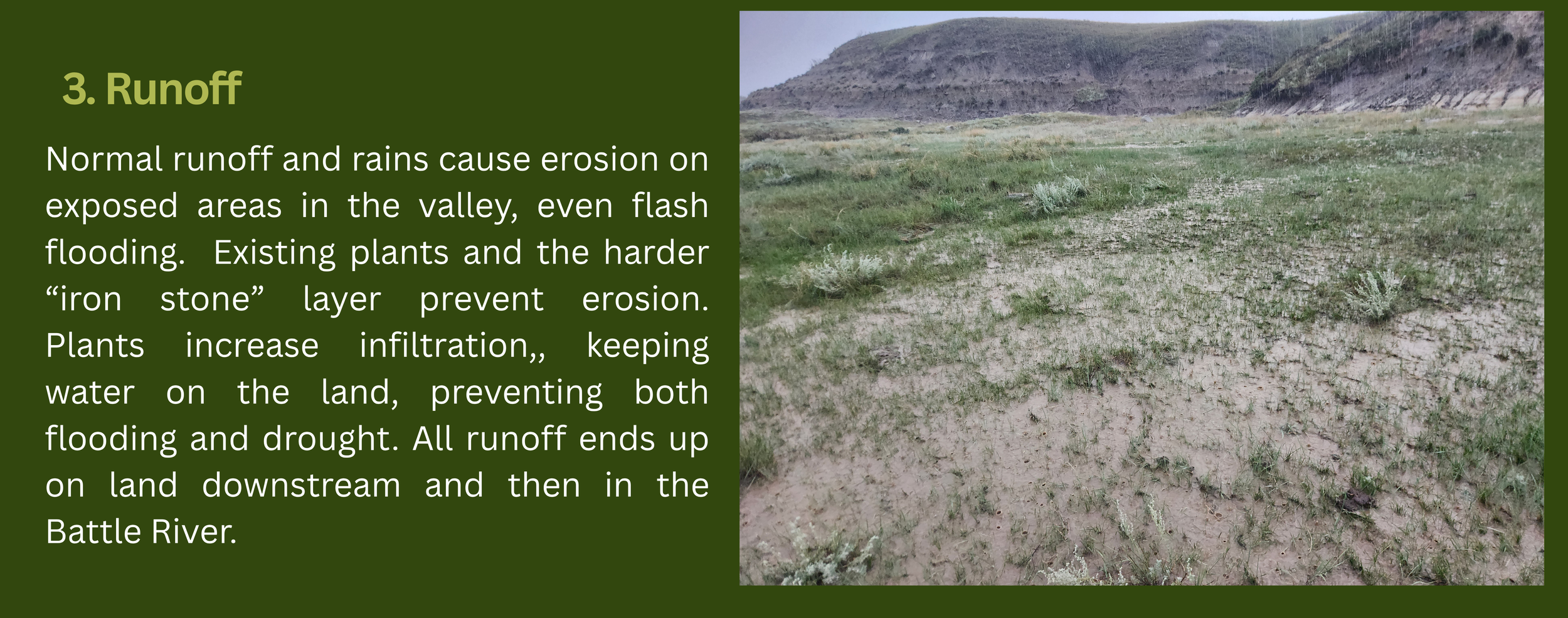
Extreme erosion is known in the area and restoration attempts have not been successful in returning the landscape to pre-disturbance levels, leaving some areas as completely unproductive. Landslides and loss of land to adjacent landowners have resulted.
Documentation from the Termination Report of Exploration on Lands Reserved…South of Rosalind shows that Section 31-42-17-W4 was the are with estimated 500,000 tonnes of sodium bentonite deposit. This area was mined between 1958-1975. The area covered under the current application are sections 19-43-17-W4 and NW-18-43-17-W4 and are different from the area identified in that report as having commercially viable quantities of sodium bentonite clay. There are strong concerns about the quantity and quality of the sodium bentonite clay in the area that is sought to be mined.
The application to Camrose County and associated correspondence for a permit states the intended use is consumer and industrial purposes, including cat litter.
Engaging in activities that could alter an intact valley complex that supports agriculture, wildlife, disappearing native plants and offers opportunities for agri-tourism raises concerns and questions about long-term sustainability.
Scroll for more details on impact to agriculture, ecosystem services, significance of erosion and features of the valley itself.
Links to Detailed Information & Sources from Section Above
revealing the old mining scars

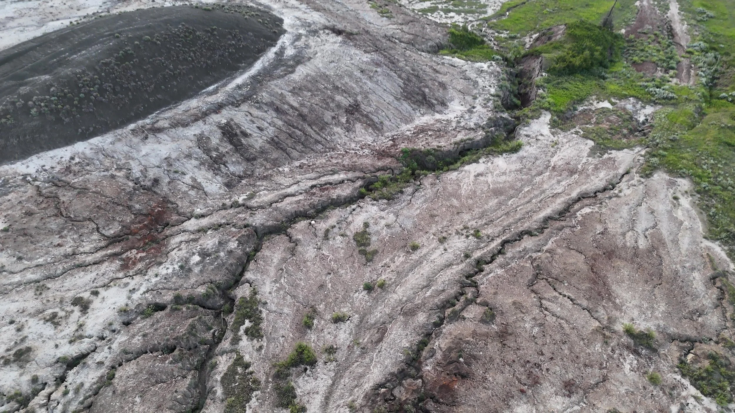
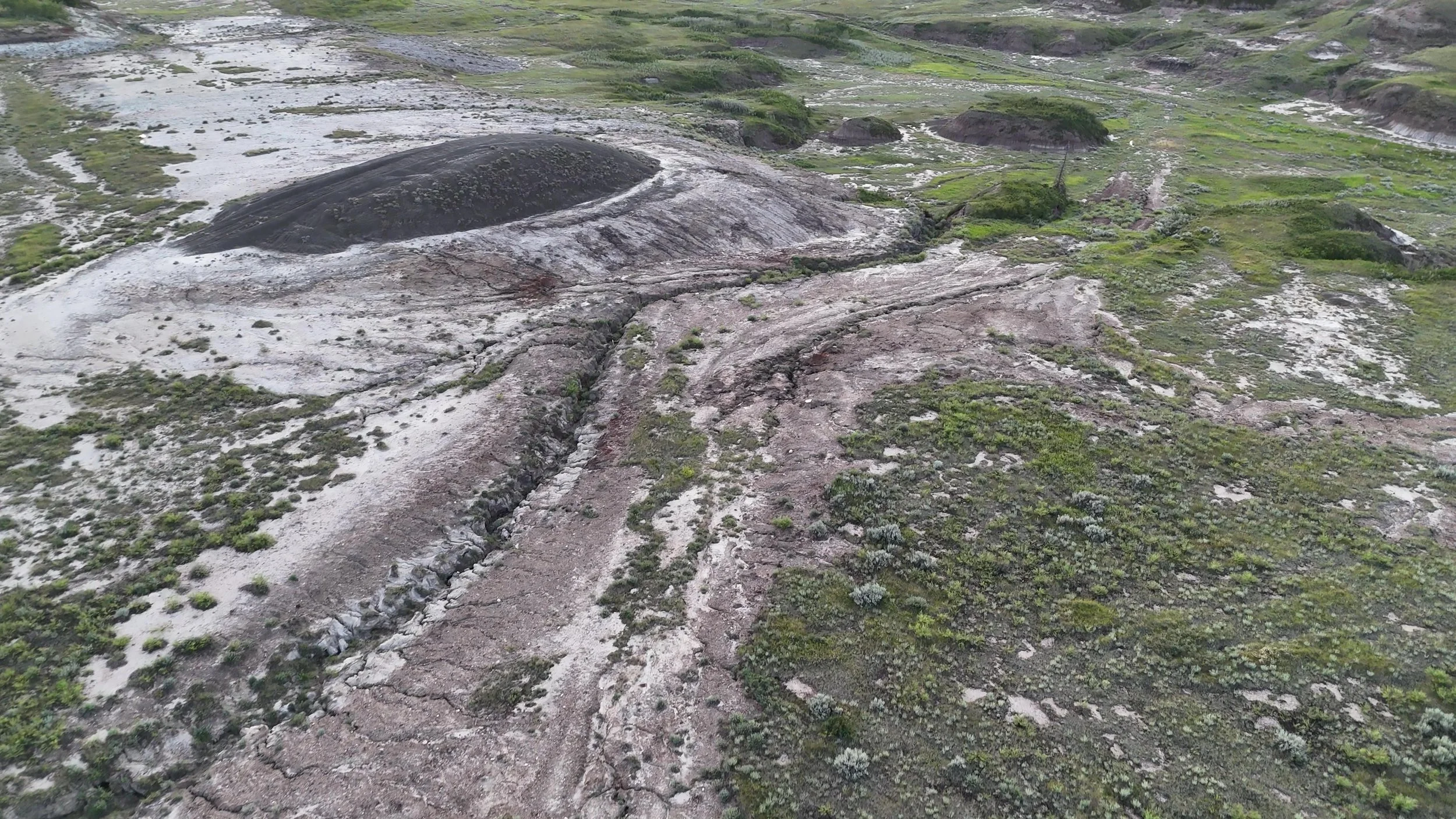
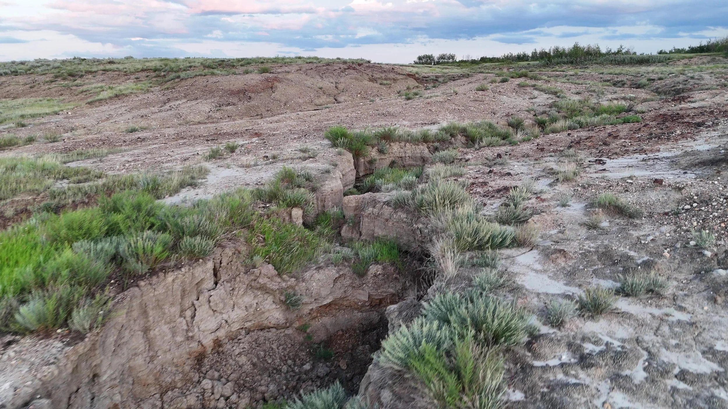
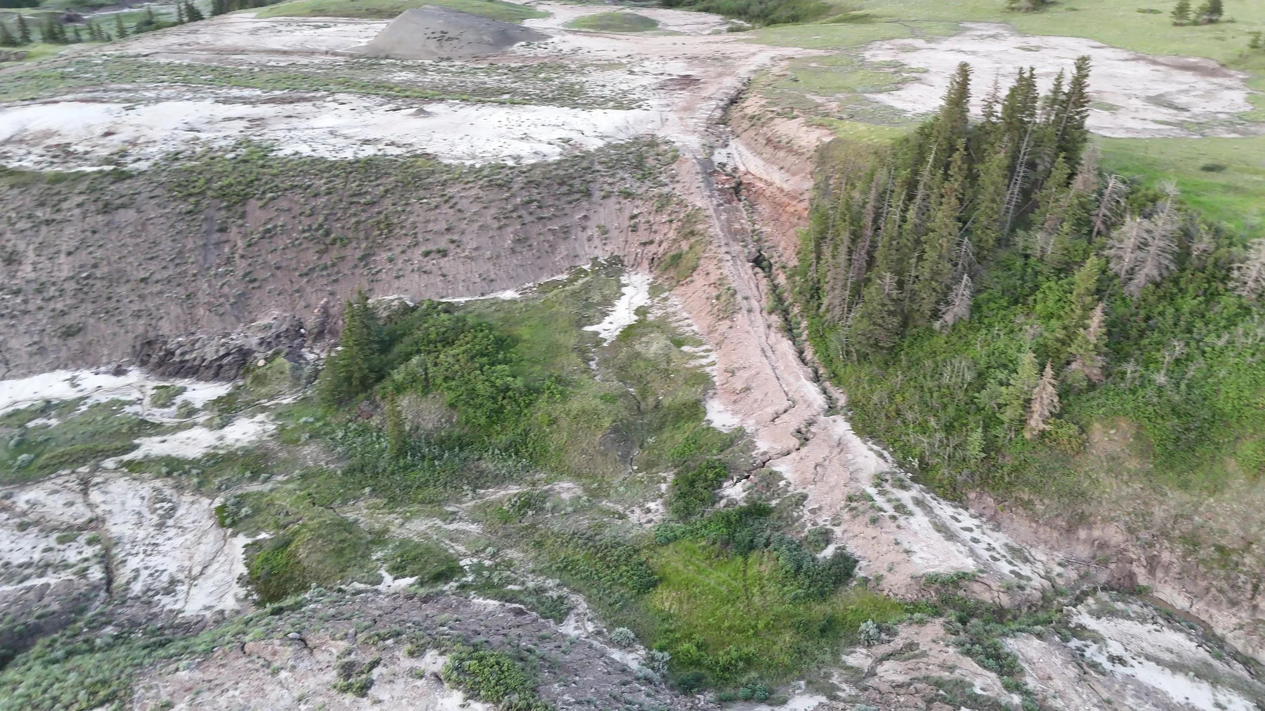
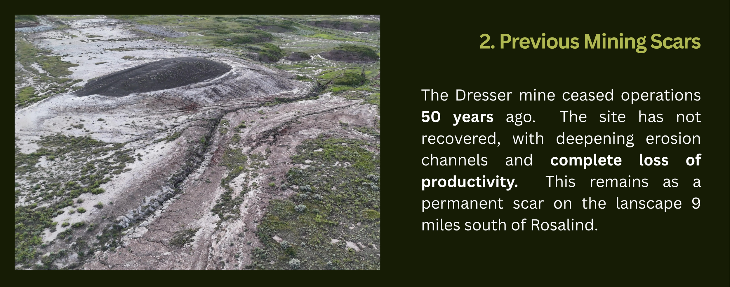
Sodium bentonite clay was mined in the valley between 1958 and 1975. In that time, the mine site has not recovered or been restored. The bedrock and formation of the valley make it extremely prone to erosion. Mechanical disturbance from strip mining, to remove sodium bentonite from the valley erased the unique features of the valley and they cannot be restored. It is a destruction of one the last remaining aspen parkland complexes in Alberta as well as the permanent loss of productive agricultural land.
50 years later, the land has still not recovered.
Deep erosion channels formed once the highly erodible bedrock was exposed. Vegetation has not re-established.
Land that was once productive for agriculture and was ecologically functional become a wasteland.
A healthy landscape relies on the native vegetation, with its deep roots, and hard “iron stone” that tops the erodible sandstone of the Horseshoe Canyon formation that is exposed.
This is the same formation that is exposed in Dinosaur Provincial Park at Drumhellar, AB.
The channel pictured is more than 6 feet deep.
Compaction from access roads can have an extreme and long-term negative impact on the native vegetation in this area. Scars from access roads still slash the landscape 50 years later.
The landscape was changed from a productive, flourishing, intact ecosystem, to an extreme liability with ongoing, long term risks for the landowner and potential risks to all those surrounding it.
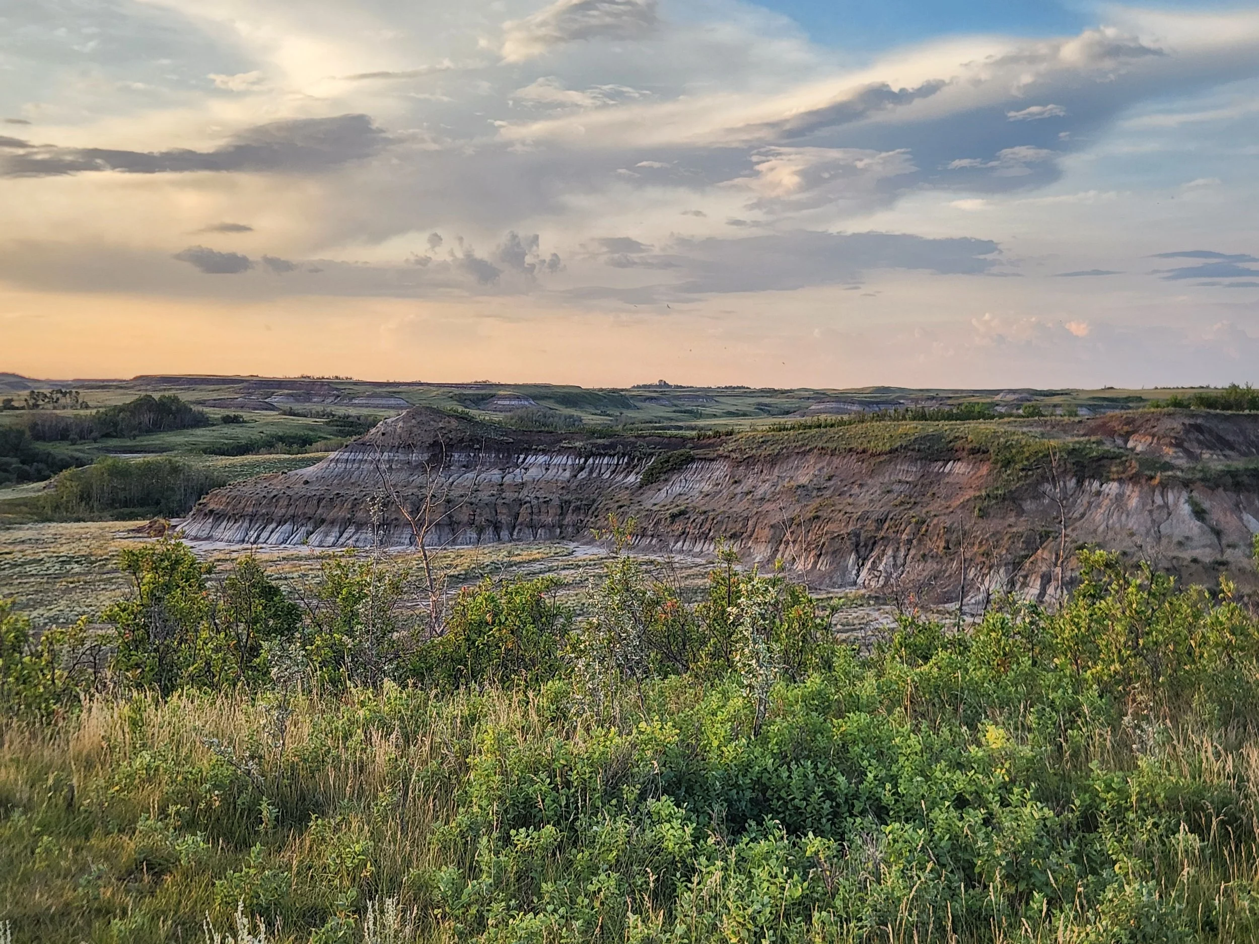
The old mine site would have looked similar to this prior to mining.
The landscape in the background of this photo is what is proposed to be mined.
This landscape is worth protecting.

known, extreme erosion
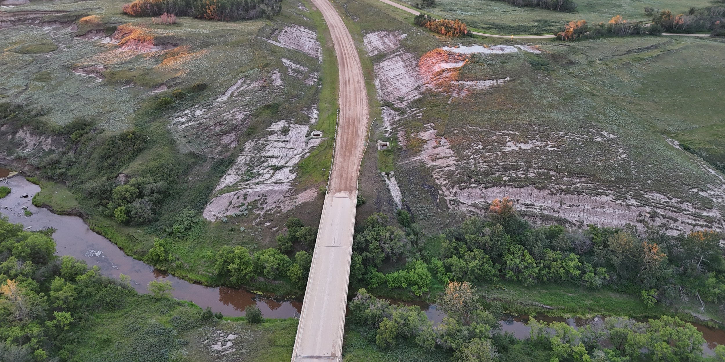
Erosion site on Hwy 854 South of Rosalind.
Bridge construction was undertaken in 1985 to replace the bridge over the Battle River on Hwy 854 south of Rosalind. The approach was changed, slopes were disturbed. In 2003, nearly 20 years later, massive erosion caused erosion channels and a landslide. Major repairs were undertaken in 2004 at expense to taxpayers and erosion continues to the present day.
This site is less than 1km from the land proposed to be strip-mined for sodium bentonite clay.
Today the site has continual erosion that requires the setting pond to be pumped out, bank slumping, lack of vegetation cover, weed invasion and continuing loss of land that belongs to private adjacent landowners.
Landowners adjacent to this geohazard appealed the mining permit granted for sodium bentonite mining, citing extreme erosion concerns in the area.
Photos 2025
Who pays the cost?
Adjacent landowners and local residents are deeply concerned about costs arising from reduced property value, visual impact of the project, environmental impacts as well as impact on their ability to fully enjoy their properties and its surrounding areas. or continue to operate current agricultural operations.
The need for long-term monitoring and associated costs are a concern, given the ongoing expenses required to address erosion and landslide impacts from local bridge construction that was undertaken 40 years ago and still requires monitoring and maintenance to mitigate, not eradicate negative impacts, as well as the current state of the Dresser Mine site, left for more than 50 years.
There are also concerns about indirect costs to taxpayers and residents, given the extended time it might take to repair the damage that could arise as well as potential damage in the mean time.
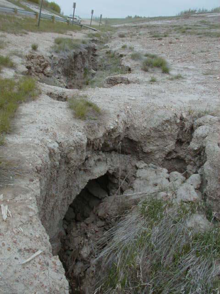
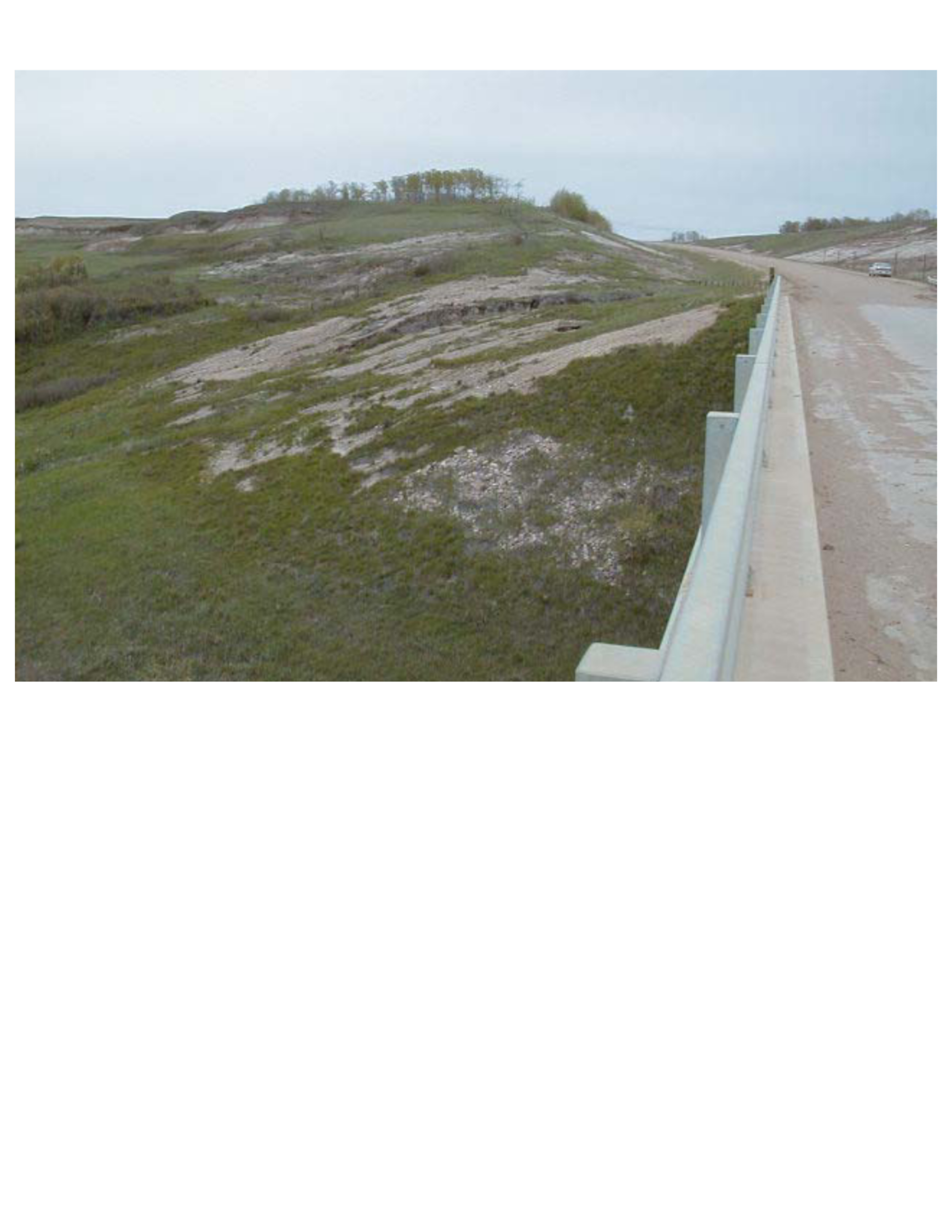
Photo Credit: The following photo sets are from the Alberta Transportation Geohazard Assessment Reports and Photos from 2003-2013 at Site C23L H:854:01, SW-18-43-17-W4, public documents available on the Alberta Transportation Website. Follow the link above.
2003 - Erosion and Landslide Geohazard Assessment Photos
East side of highway: Major erosion channel down a steep slope.
According to the Klohn Crippen As-Built Report (2004) to Alberta Transportation, Erosion Mitigation at the Bridge over the Battle River in 2003 Cost $187,883 to attempt reclamation on approximately 3.25 acres. Adjusted for inflation, that would be over $303,000. Efforts outlined in that report were not fully successful and further associated costs are still being investigated.
Reclamation efforts cost an equivalent of over $93,000 per acre and erosion and loss of adjacent land persists to present day. The report noted the “high erosion potential of the soils.”
This site is less than 1km from the proposed sodium bentonite clay mining activities and 9km south of Rosalind. Reclamation costs are extensive due to the unique features of this area and make disturbance potentially unprofitable.
Central Region Landslide Assessement Sit C23 H854:01 Battle River Bridge Crossing (BF9511) Erosion Repair As-Built Report, (Klohn Crippen, 2004)
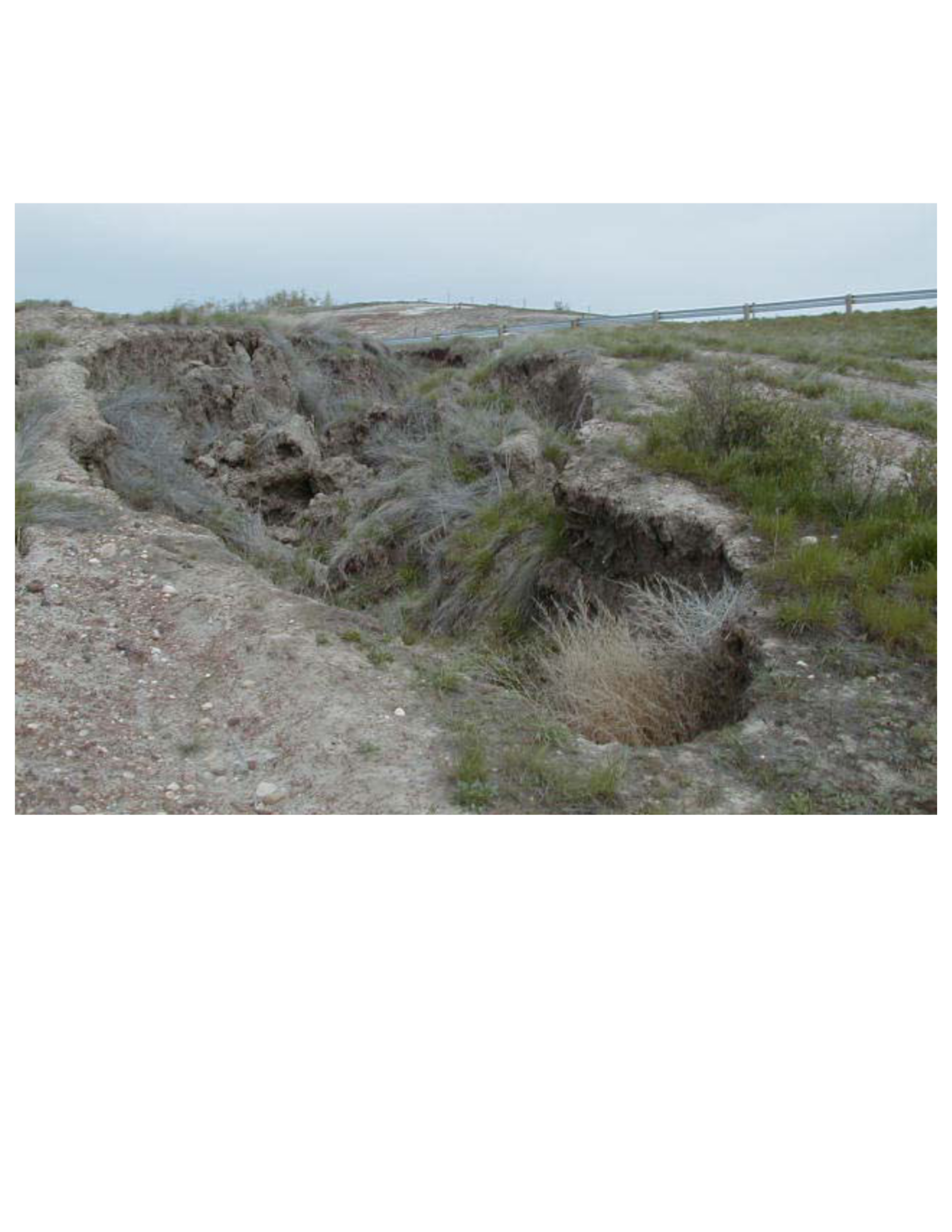
West side of highway: Erosion channels, some running under the surface. Sediment dumping into the Battle River causing siltation and further erosion of opposite bank.
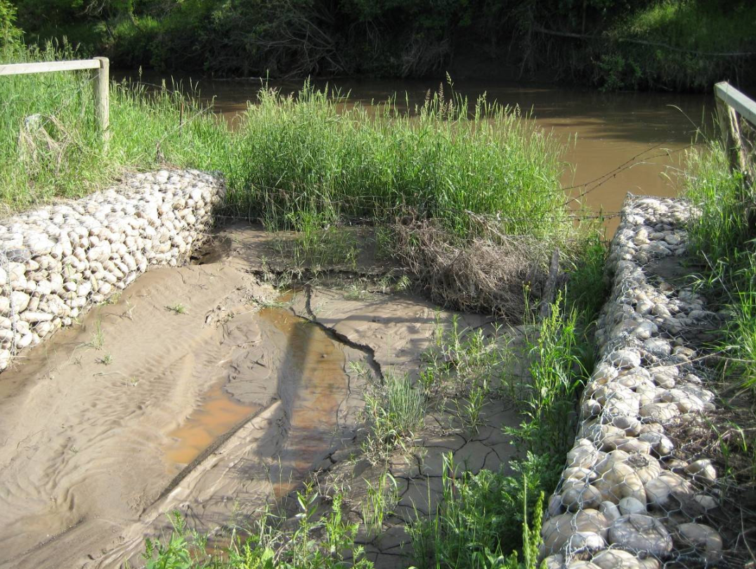
2008 - Erosion and Landslide Geohazard Assessment Photos
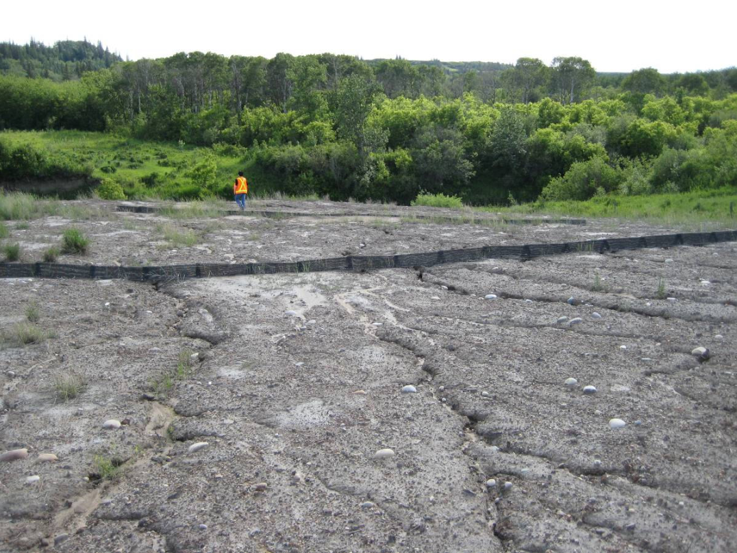
2009 - Erosion and Landslide Geohazard Assessment Photos
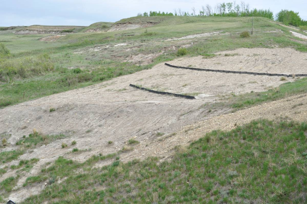
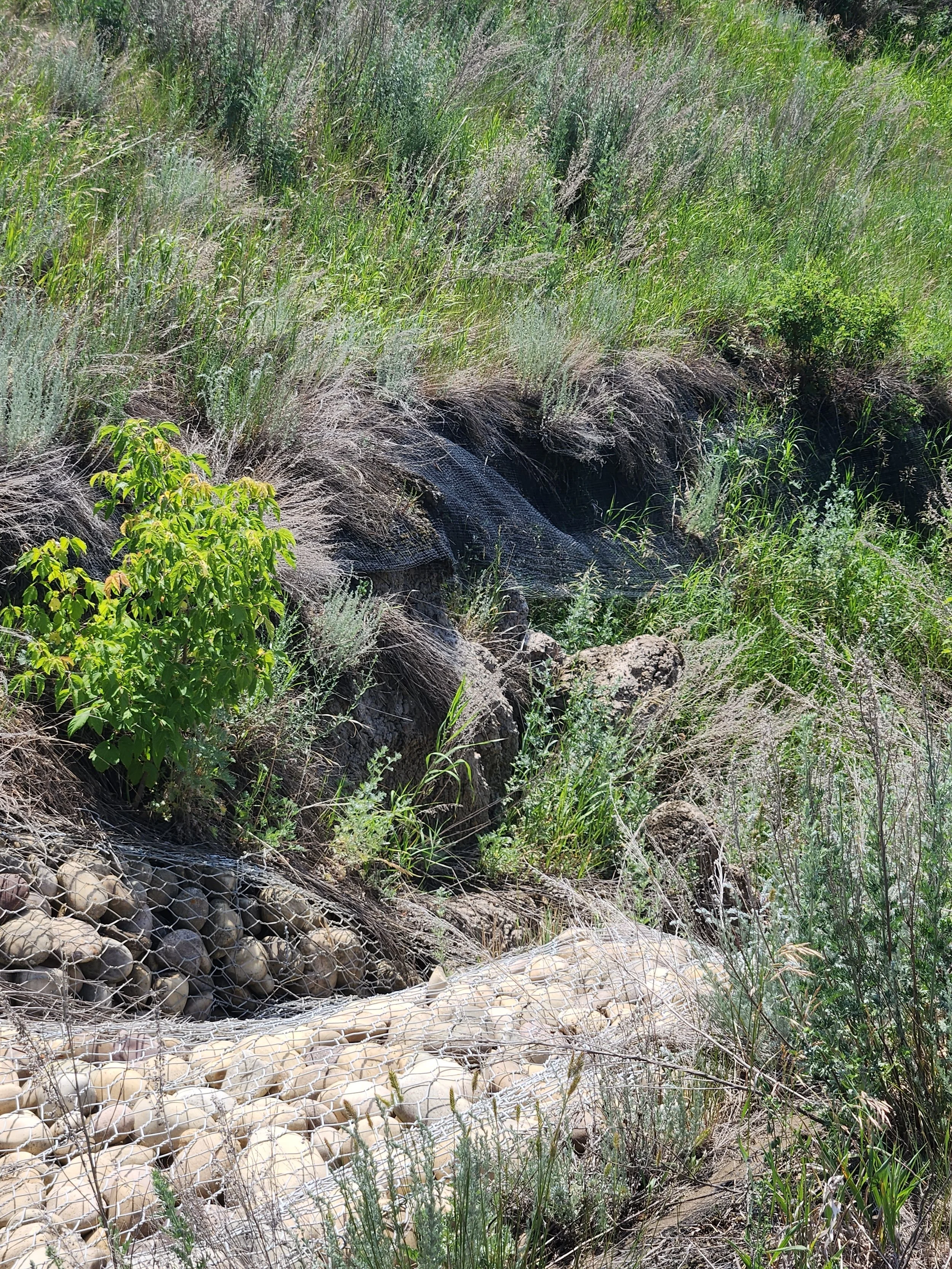
Conventional reclamation efforts have been unsuccessful at re-establishing native vegetation at this site. Weeds, including Artemisia absinthia, wormwood (pictured), which is designated as a “problem weed” by Camrose County (2026), are present. Native vegetation has deep roots that are critical for stabilizing soil in this area in order to prevent erosion. Once it is disturbed it may not be possible to put it back, particularly if there is any kind of slope impacted. Erosion is a major factor in the loss of agricultural land. The introduction of weeds and invasive species are identified as having negative consequences for nearby vegetated areas, including riparian areas (Campbell, 2014), and invasive species can outcompete native flora and negatively impact ecosystem function (Zapisocki et al., 2022).
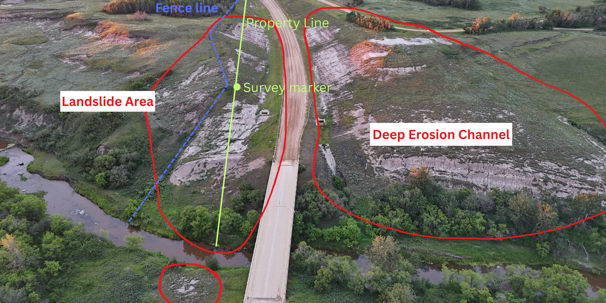
Green arrow indicates Property line impacted by adjacent, ongoing erosion.
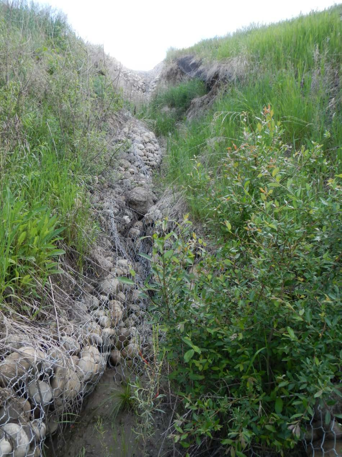
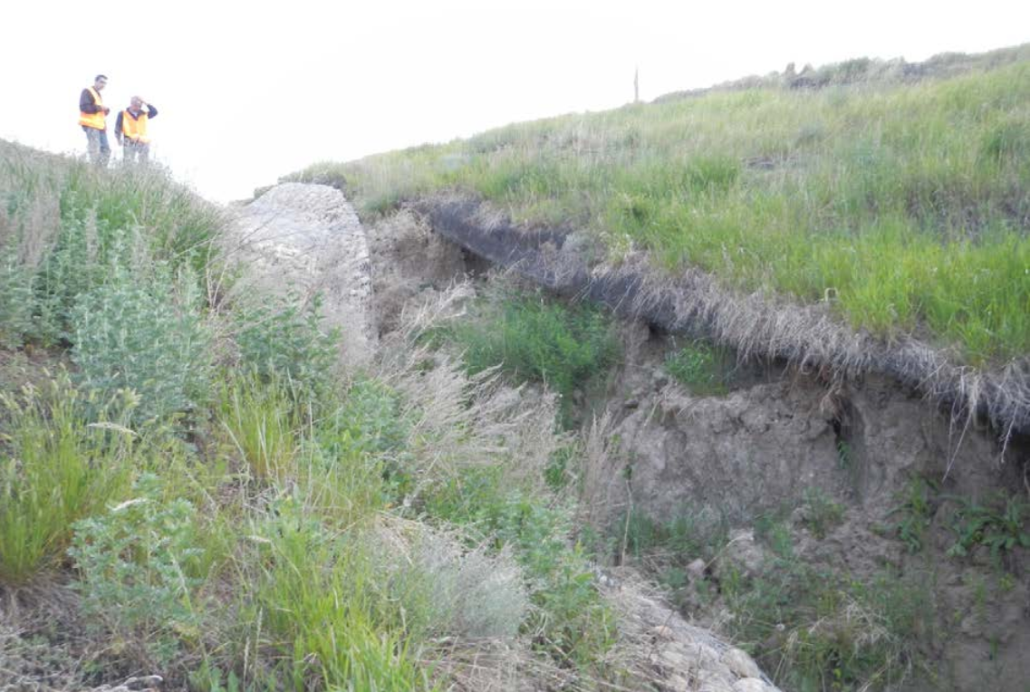
2012 - Erosion and Landslide Geohazard Assessment Photos
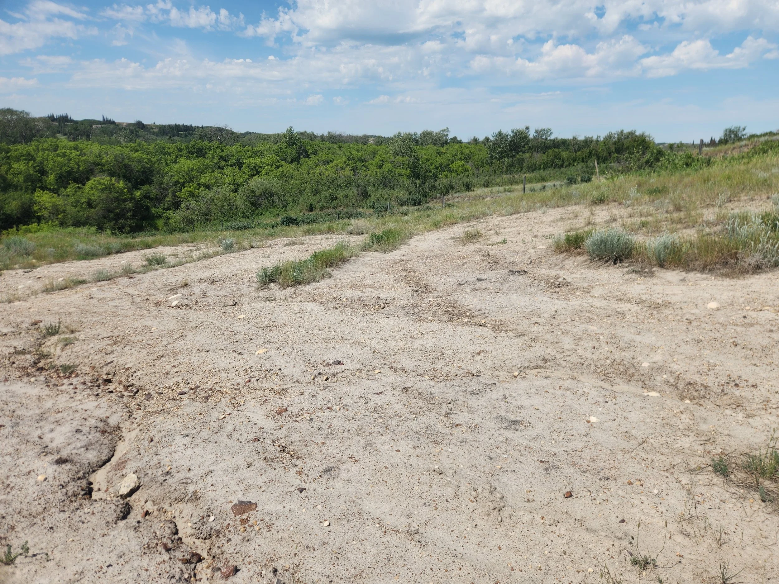
known negative impact on adjacent agricultural operations
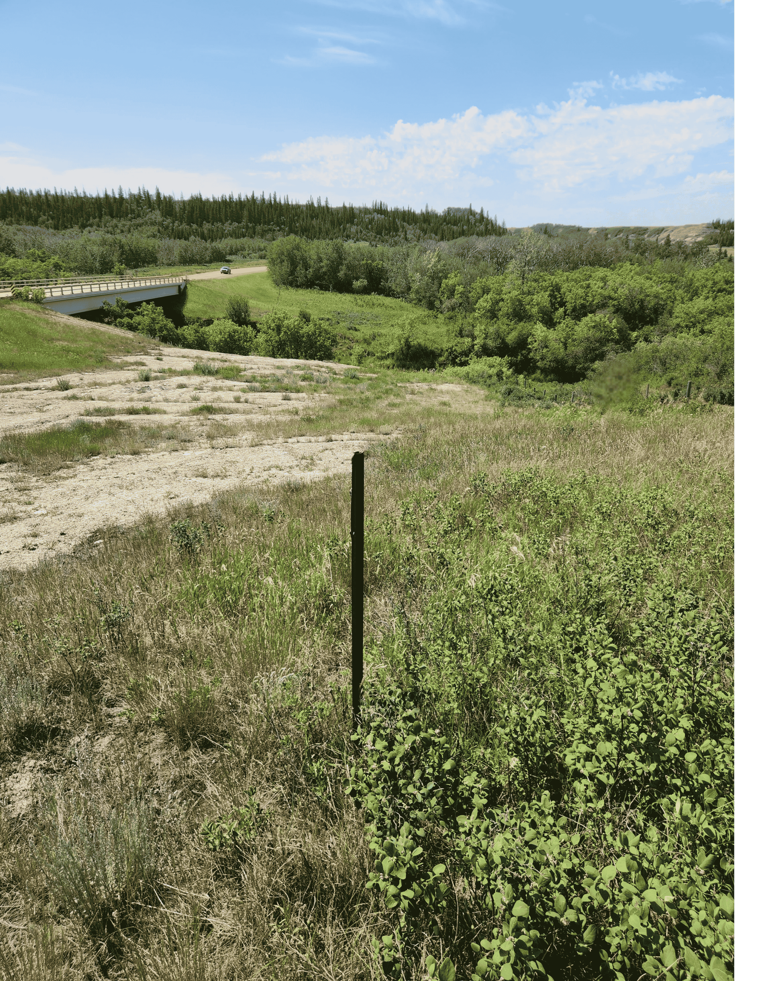
Land is still being lost to erosion
Photos from July 2025
Above: The property marker in the center foreground shows how far the fence has been moved and how much land has been lost.
Erosion continues on the other side of the fenceline, on adjacent property. Erosion travels regardless of property lines. Landowners are still waiting for the problem to be fixed.
When the landscape is gone, it is gone forever. The possibility of permanent loss of productive, agricultural landscape needs to be non-negotiable.
Agriculture is the beating heart of our community.
We are concerned about these potential long-term, negative impacts on many local families and farming operations in our community.
Ignoring the risks has the potential of altering productive agricultural and ecologically significant landscapes and creating significant long-term risks and potential liabilities for landowners.
a landscape worth protecting
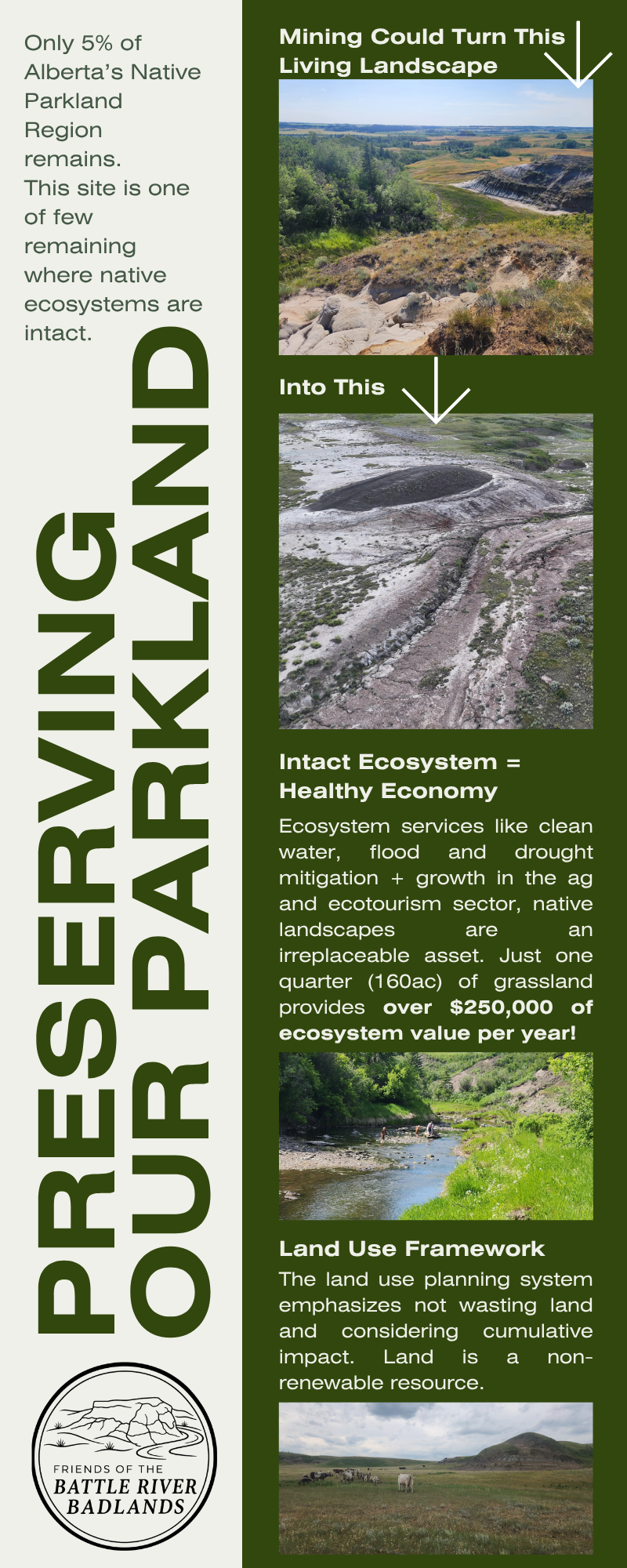
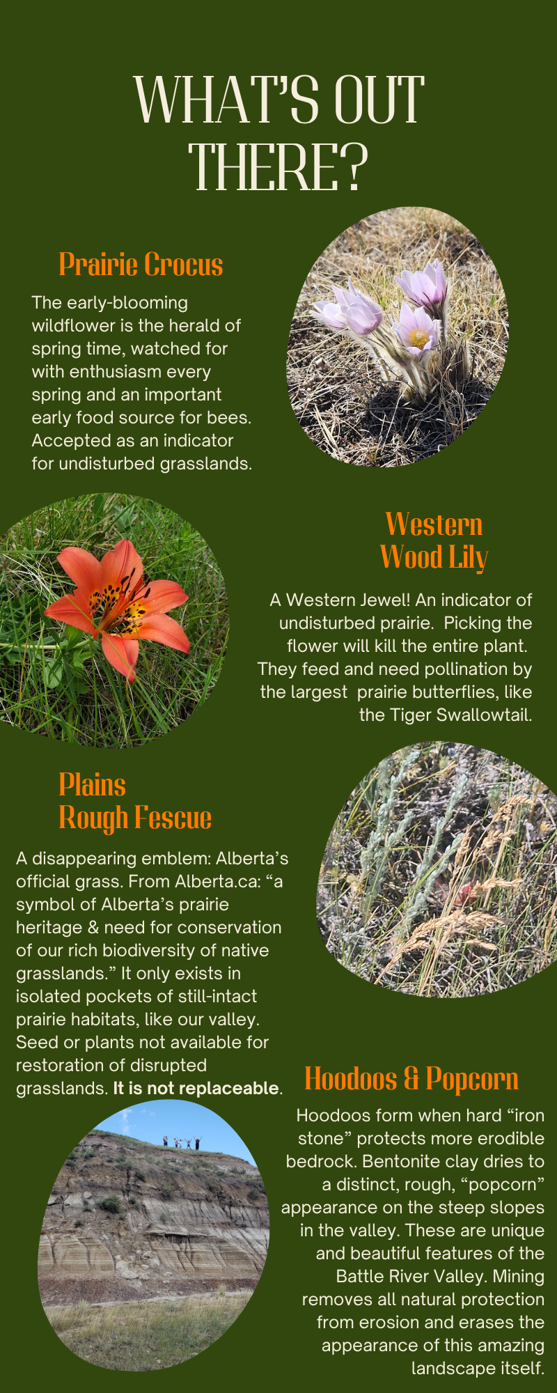

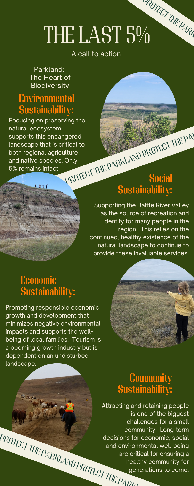
calculating the value of natural ecosystems
A Health in the Watershed Atlas of the Battle River and Sounding Creek Watersheds integrated indicators of ecological, social and economic health. The estimated societal benefits provided by natural ecosystems of the Paintearth Subbasin of the Battle River, where this area is located, were valued at $696 million in 2011 (Hallstrom, 2022). Adjusted for inflation, that would be upwards of $976 million today. Recent ecosystem valuation calculations estimate the value even higher.
Landscape connectivity is critical for maintaining ecosystem function and biodiversity (Liu et al, 2018). Connected landscapes are more adaptive and resilient than those that are fragmented (Government of AB, 2008). This area contains grassland ecosystems. Provincially, only 5% of native vegetation remains (Government of AB, 2006). Maintaining the value of ecosystem benefits requires that this ecosystem, this landscape, remains intact.
learn more about this unique natural area
So What’s the Big Deal?
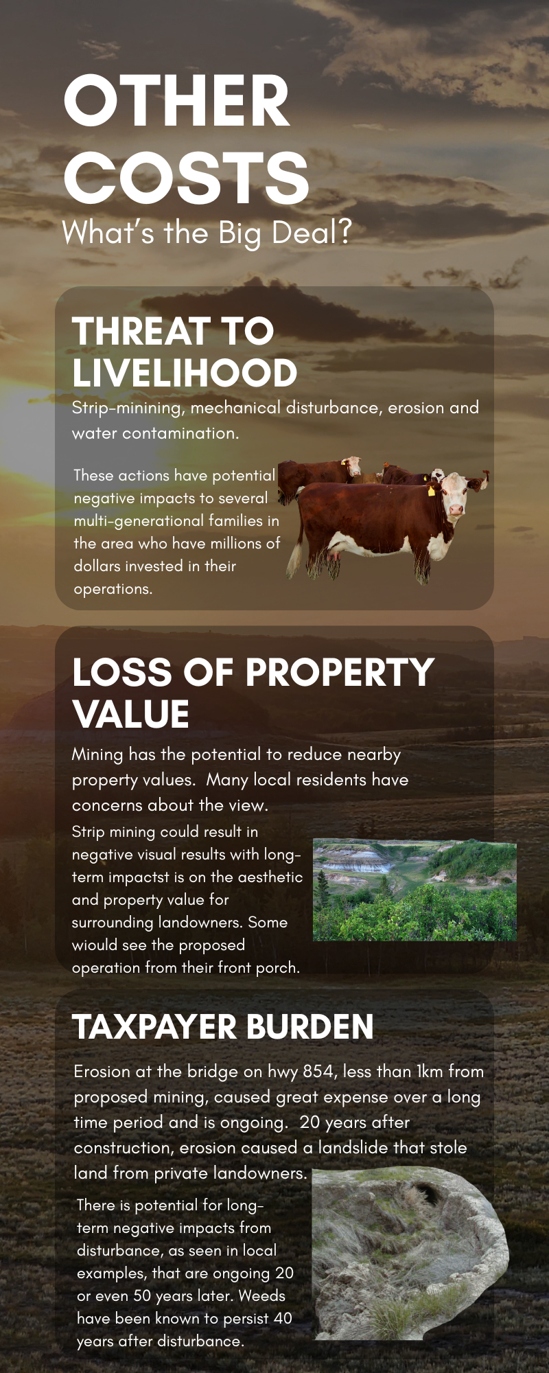

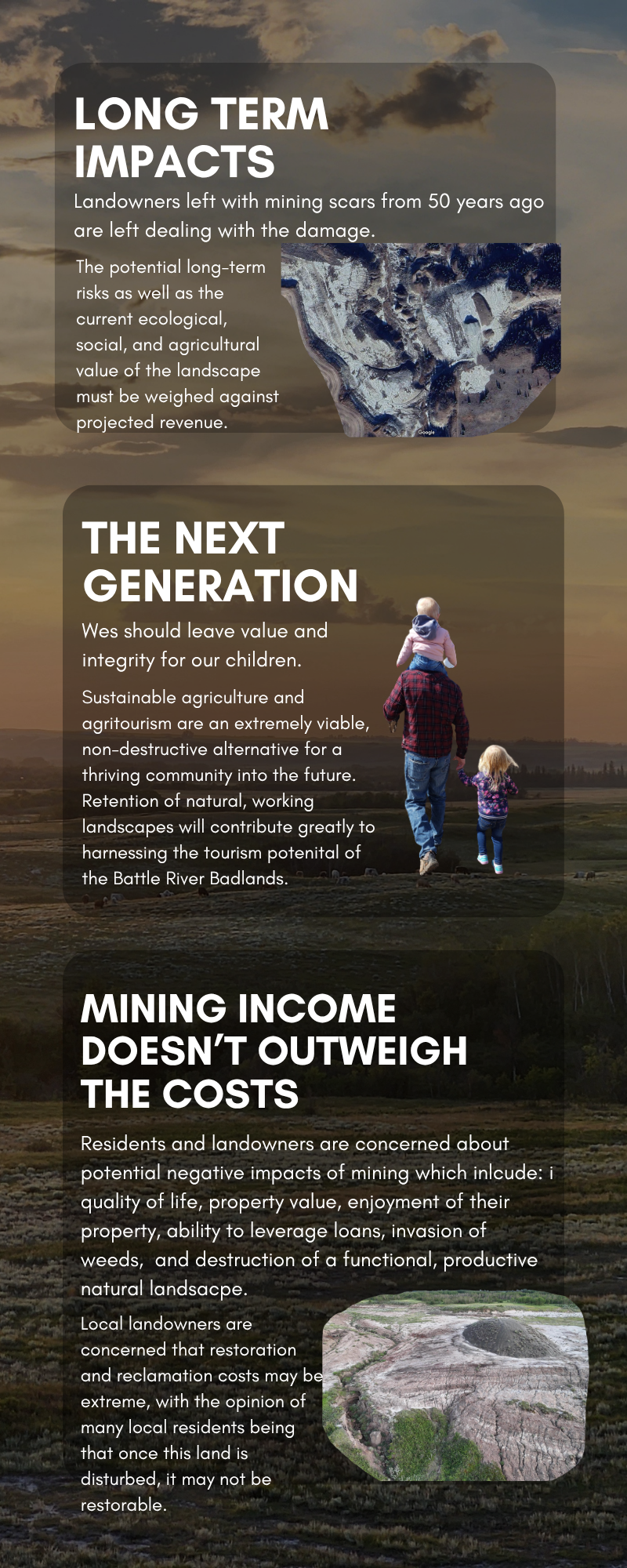
While a proposed development promising substantial revenue might seem like a great opportunity, the landowners believe that projected financial gains must be carefully balanced against long-term costs before approving projects that involve major soil disturbance and potential long-term impacts.
A thorough, independent economic assessment that weighs community impacts across agricultural, social, recreational, environmental, and cultural factors is a critical step in responsible land-use planning. A comprehensive third-party economic study could have provided Camrose County with valuable clarity prior to deciding on the permit.
Anticipated negative impacts on adjacent agricultural operations and local agritourism ventures alone requires that careful evaluation, which also considers indirect community costs, is undertaken and understood.
Potential effects on adjacent property values and land-financing options near active or former industrial sites remain major concerns for local residents and landowners.
Furthermore, because formal notice was limited to those within the minimum statutory distance, many affected landowners outside the radius were unaware of the approved permit until after the formal appeal window had passed.
Target for Tourism
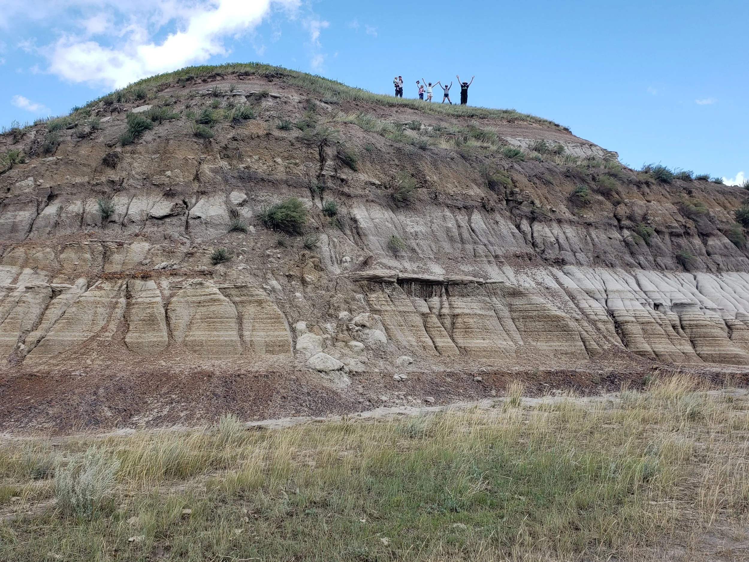
This picturesque natural landscape is a gem that can attract visitors to our area. Agritourism and ecotourism in natural, local areas like this is booming.
With travelers staying closer to home, investment in local adventures is a growing trend. With it comes opportunities for luxury getaways, food services, and diversification of existing agricultural operations.
Local agri-tourism ventures already exist in our community and is seeking to grow: farm tours, farm to table opportunities, eco-tours, event venues, campgrounds, accommodation and more. Local tourism should be wholeheartedly supported as a non-destructive economic driver for our area.
This is in alignment with Camrose County’s own tourism mandate: Camrose County's rich agricultural landscape provides fertile ground for investment in farm tours and other ag experiences. (From Camrose County Website May 20, 2025; Tourism | Camrose County)
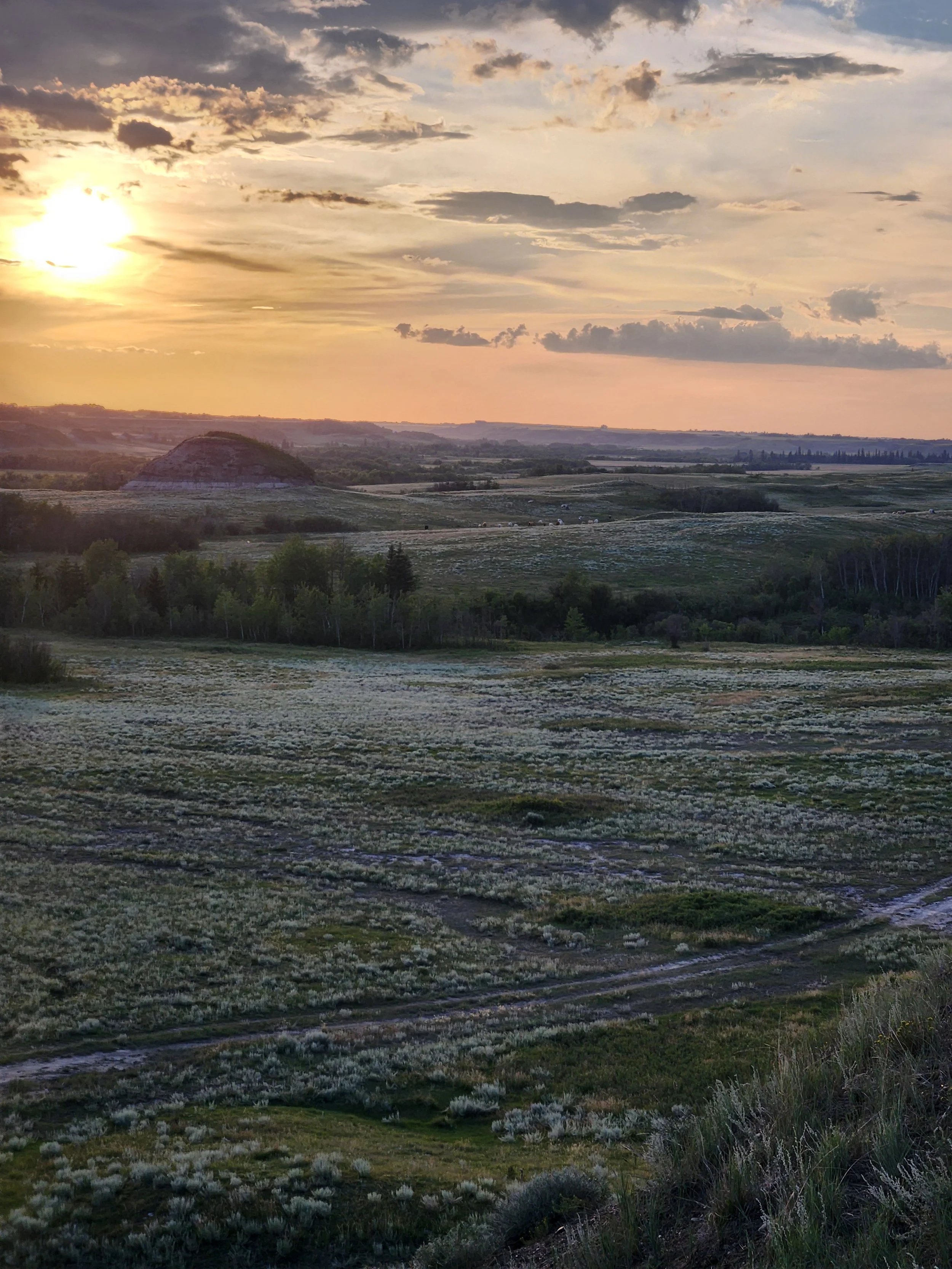
Alberta’s Tourism Strategy has set a goal of building the provincial tourism industry to $25 billion in annual visitor spending by 2035.
With a key pillars to “attract investment into the development of unique products, experiences and destinations that enable our province to shine,” our area is uniquely situated to grow as a tourism destination. Alberta.ca | Tourism Strategy
Maintaining an intact landscape will contribute greatly to harnessing the tourism potential of the Battle River Badlands.
take action
your neighbours need your support: talk to us, hear more about what we’re doing to protect our parkland and our community, share the message
get in touch with us to see how you can help, walk the landscape, or to learn more about this amazing area and why we want to protect it for generations to come
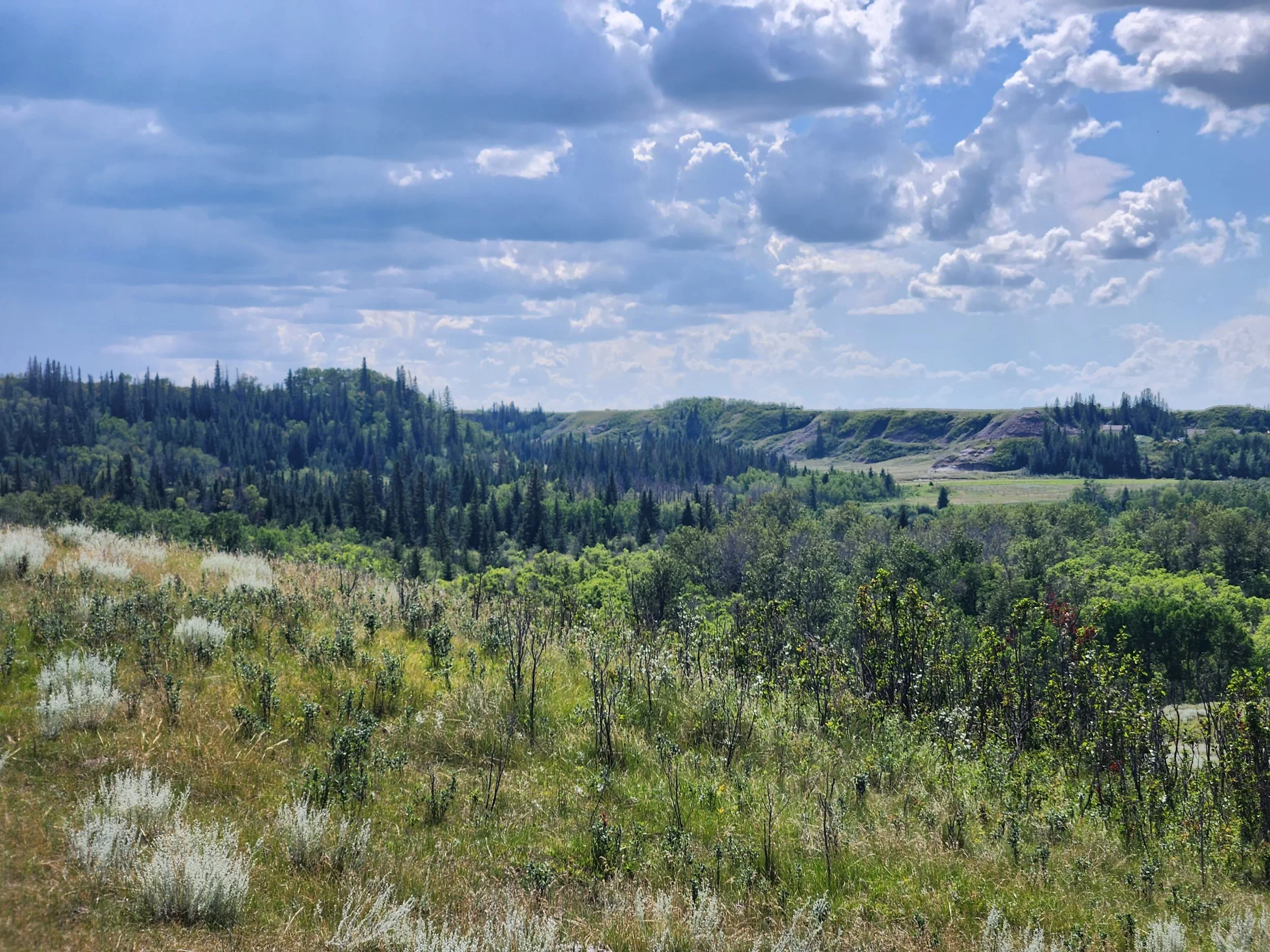
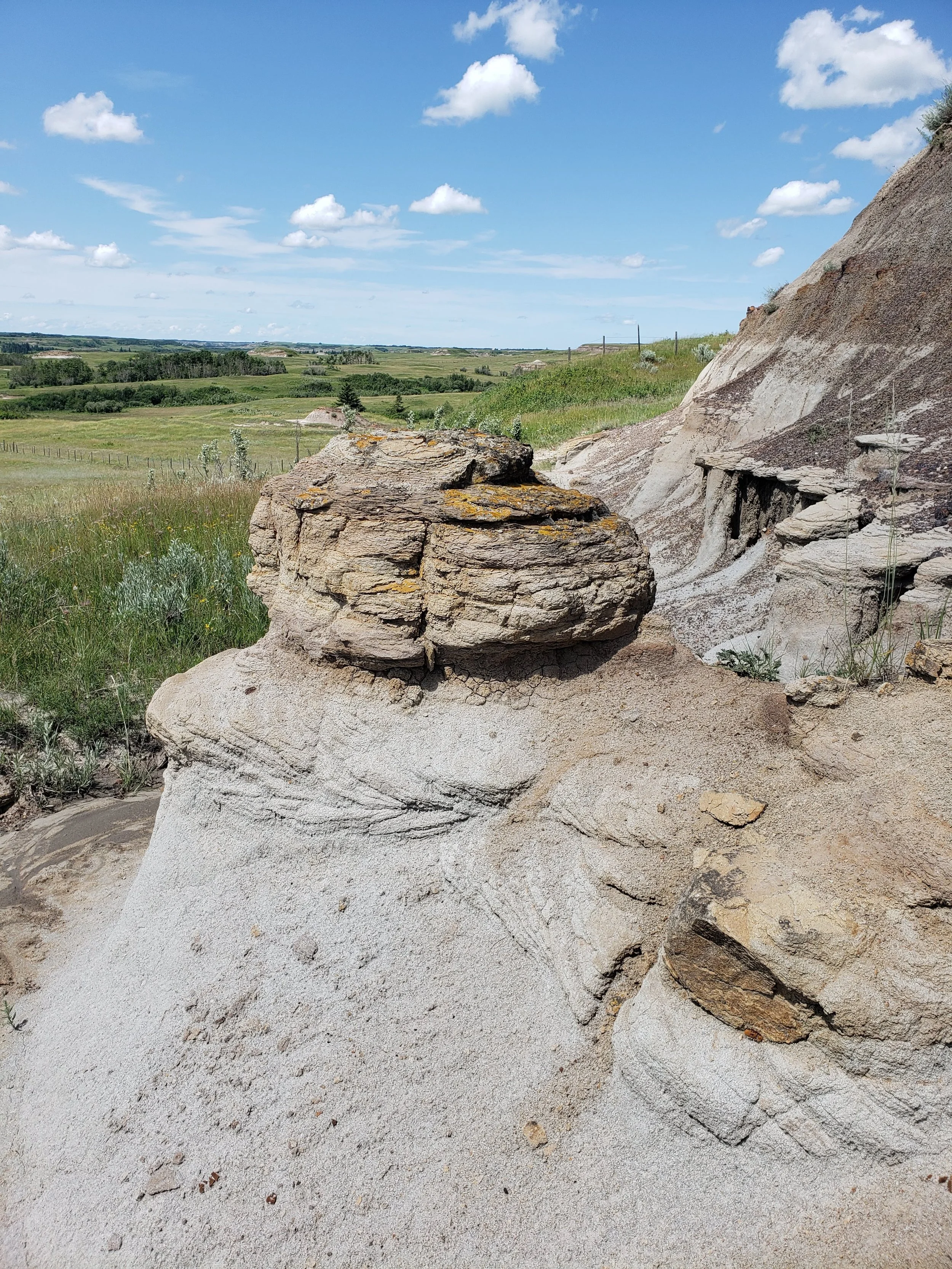
All conclusions and suggested potential outcomes presented in this website are the opinions of the Battle River Badlands Society. These opinions are based in published research, first-hand experiences and knowledge based in the local vicinity.